Vattetot-sous-Beaumont geodata
Vattetot-sous-Beaumont (Normandy) is a populated place; located in France in Europe/Paris (GMT+2) time zone. With population of 505 people, there are 15148 cities with bigger population in this country. Compared to other cities in France, 90.8% of cities are located further ↓South; 73.9% of cities are located further →East and 50.9% of cities have higher elevation than Vattetot-sous-Beaumont. Note1
Administrative division(s):
- Level 1: Normandy
- Level 2: Seine-Maritime
- Level 3: Arrondissement du Havre
- Level 4: Vattetot-sous-Beaumont
Current local time in Vattetot-sous-Beaumont:
07:20 AM, SaturdayDifference from your time zone: hours


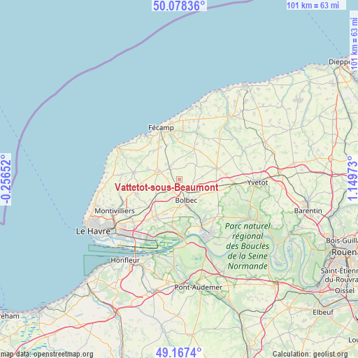
Vattetot-sous-Beaumont GPS coordinates[2]
49° 37' 30.036" North, 0° 26' 47.76" East
| Map corner | latitude | longitude |
|---|---|---|
| Upper-left | 50.07836°, | -0.25652° |
| Center: | 49.62501°, | 0.4466° |
| Lower-right: | 49.1674°, | 1.14973° |
| Map W x H: | 101.3×101.3 km | = 62.9×62.9mi |
| max Lat: | 51.07786° ⇑9.2% North |
| Vattetot-sous-Beaumont: | 49.62501° |
| min Lat: | ⇓90.8% South 41.3874° |
| min Long | Vattetot-sous-B | max Long |
| -5.08615° | 0.4466° | 9.52242° |
| W 26.1%⇐ | ⇒73.9% E |
Elevation
Elevation of Vattetot-sous-Beaumont is 129 m = 423 ft, and this is 64.7 m = 212 ft below average elevation for this country.
| Max E: |
2333 m = 7654 ft | 50.9% |
| Avg. | 193.7 m = 635 ft | |
| Vattetot-sous-Beaumont | 129 m = 423 ft | |
Min E: |
-1 m = -3 ft | 49.1% |
See also: France elevation on elevation.city.
Geographical zone
Vattetot-sous-Beaumont is located in North temperate zone (between Tropic of Cancer and the Arctic Circle). Distance of this North polar circle is 1883.4 km =1170.3 mi to North.| Distance of | km | miles | from Vattetot-sous-Beaumont |
|---|---|---|---|
| North Pole | 4489.3 | 2789.5 | to North |
| Arctic Circle | 1883.4 | 1170.3 | to North |
| Tropic Cancer | 2911.9 | 1809.4 | to South |
| Equator | 5517.8 | 3428.6 | to South |


Nearby cities:
15 places around Vattetot-sous-Beaumont: (largest is in red/bold)
• Bernières
2.3 km =1.4 mi,  98°
98°
• Beuzeville-la-Grenier
4 km =2.5 mi,  200°
200°
• Bolbec
6.1 km =3.8 mi,  161°
161°
• Bretteville-du-Grand-Caux
5.7 km =3.5 mi,  324°
324°
• Bréauté
3.4 km =2.1 mi,  275°
275°
• Goderville
6.2 km =3.9 mi,  291°
291°
• Gruchet-le-Valasse
8.3 km =5.2 mi, 159°
• Hattenville
7.2 km =4.5 mi,  65°
65°
• Lanquetot
7.3 km =4.5 mi,  127°
127°
• Manneville-la-Goupil
6.8 km =4.2 mi,  256°
256°
• Nointot
3.7 km =2.3 mi,  143°
143°
• Rouville
3.9 km =2.4 mi, 102°
• Saint-Eustache-la-Forêt
8.2 km =5.1 mi,  175°
175°
• Saint-Gilles-de-la-Neuville
7.6 km =4.7 mi,  222°
222°
• Yébleron
6.6 km =4.1 mi,  81°
81°
Sources, notices
• [Note1] Compared only with cities in France existing in our database
• [Src1] Map data: © OpenStreetMap contributors (CC-BY-SA)
• [Src2] Other city data from geonames.org with taken over terms of usage.
• [Src3] Geographical zone / Annual Mean Temperature by Robert A. Rohde @ Wikipedia
