Hattenville geodata
Hattenville (Normandy) is a populated place; located in France in Europe/Paris (GMT+2) time zone. With population of 562 people, there are 13969 cities with bigger population in this country. Compared to other cities in France, 91.1% of cities are located further ↓South; 73.1% of cities are located further →East and 50.2% of cities have higher elevation than Hattenville. Note1
Administrative division(s):
- Level 1: Normandy
- Level 2: Seine-Maritime
- Level 3: Arrondissement du Havre
- Level 4: Hattenville


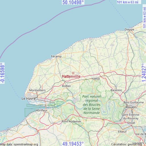
Hattenville GPS coordinates[2]
49° 39' 6.768" North, 0° 32' 13.74" East
| Map corner | latitude | longitude |
|---|---|---|
| Upper-left | 50.10498°, | -0.16598° |
| Center: | 49.65188°, | 0.53715° |
| Lower-right: | 49.19453°, | 1.24027° |
| Map W x H: | 101.2×101.2 km | = 62.9×62.9mi |
| max Lat: | 51.07786° ⇑8.9% North |
| Hattenville: | 49.65188° |
| min Lat: | ⇓91.1% South 41.3874° |
| min Long | Hattenville | max Long |
| -5.08615° | 0.53715° | 9.52242° |
| W 26.9%⇐ | ⇒73.1% E |
Elevation
Elevation of Hattenville is 131 m = 430 ft, and this is 62.7 m = 206 ft below average elevation for this country.
| Max E: |
2333 m = 7654 ft | 50.2% |
| Avg. | 193.7 m = 635 ft | |
| Hattenville | 131 m = 430 ft | |
Min E: |
-1 m = -3 ft | 49.8% |
See also: France elevation on elevation.city.
Geographical zone
Hattenville is located in North temperate zone (between Tropic of Cancer and the Arctic Circle). Distance of this North polar circle is 1880.4 km =1168.4 mi to North.| Distance of | km | miles | from Hattenville |
|---|---|---|---|
| North Pole | 4486.3 | 2787.7 | to North |
| Arctic Circle | 1880.4 | 1168.4 | to North |
| Tropic Cancer | 2914.9 | 1811.2 | to South |
| Equator | 5520.8 | 3430.5 | to South |


Nearby cities:
15 places around Hattenville: (largest is in red/bold)
• Bec-de-Mortagne
8.4 km =5.2 mi,  310°
310°
• Bernières
5.4 km =3.4 mi,  231°
231°
• Beuzevillette
9 km =5.6 mi,  180°
180°
• Bolbec
9.9 km =6.2 mi,  207°
207°
• Bolleville
6.1 km =3.8 mi,  161°
161°
• Bretteville-du-Grand-Caux
10 km =6.2 mi,  279°
279°
• Fauville-en-Caux
3.9 km =2.4 mi,  88°
88°
• Lanquetot
7.4 km =4.6 mi,  185°
185°
• Nointot
7.4 km =4.6 mi,  216°
216°
• Normanville
6.3 km =3.9 mi,  40°
40°
• Ourville-en-Caux
9.8 km =6.1 mi,  29°
29°
• Rouville
4.7 km =2.9 mi, 215°
• Trouville
9.9 km =6.2 mi,  152°
152°
• Vattetot-sous-Beaumont
7.2 km =4.5 mi,  245°
245°
• Yébleron
2.1 km =1.3 mi, 179°
Sources, notices
• [Note1] Compared only with cities in France existing in our database
• [Src1] Map data: © OpenStreetMap contributors (CC-BY-SA)
• [Src2] Other city data from geonames.org with taken over terms of usage.
• [Src3] Geographical zone / Annual Mean Temperature by Robert A. Rohde @ Wikipedia
