Valsonne geodata
Valsonne (Auvergne-Rhône-Alpes) is a populated place; located in France in Europe/Paris (GMT+2) time zone. With population of 762 people, there are 11040 cities with bigger population in this country. Compared to other cities in France, 66.9% of cities are located further ↑North; 71.6% of cities are located further ←West and 92.7% of cities have lower elevation than Valsonne. Note1
Administrative division(s):
- Level 1: Auvergne-Rhône-Alpes
- Level 2: Département du Rhône
- Level 3: Arrondissement de Villefranche-sur-Saône
- Level 4: Valsonne


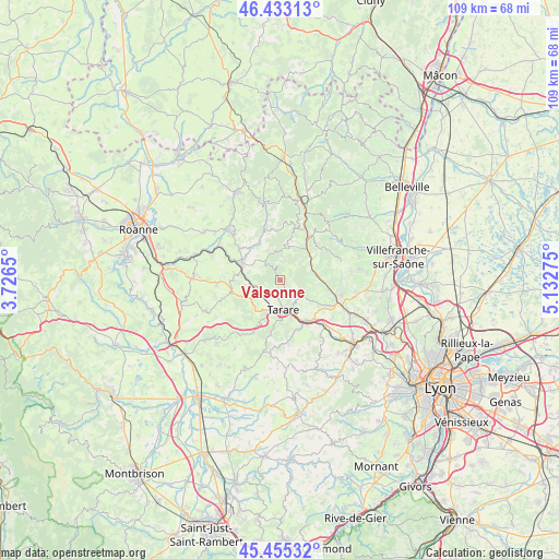
Valsonne GPS coordinates[2]
45° 56' 46.968" North, 4° 25' 46.632" East
| Map corner | latitude | longitude |
|---|---|---|
| Upper-left | 46.43313°, | 3.7265° |
| Center: | 45.94638°, | 4.42962° |
| Lower-right: | 45.45532°, | 5.13275° |
| Map W x H: | 108.7×108.7 km | = 67.5×67.5mi |
| max Lat: | 51.07786° ⇑66.9% North |
| Valsonne: | 45.94638° |
| min Lat: | ⇓33.1% South 41.3874° |
| min Long | Valsonne | max Long |
| -5.08615° | 4.42962° | 9.52242° |
| W 71.6%⇐ | ⇒28.4% E |
Elevation
Elevation of Valsonne is 495 m = 1624 ft, and this is 301.3 m = 989 ft above average elevation for this country.
| Max E: |
2333 m = 7654 ft | 7.3% |
| Valsonne | 495 m 1624 ft | |
| Avg. | 193.7 m = 635 ft | |
Min E: |
-1 m = -3 ft | 92.7% |
See also: France elevation on elevation.city.
Geographical zone
Valsonne is located in North temperate zone (between Tropic of Cancer and the Arctic Circle). Distance of this North polar circle is 2292.4 km =1424.4 mi to North.| Distance of | km | miles | from Valsonne |
|---|---|---|---|
| North Pole | 4898.3 | 3043.7 | to North |
| Arctic Circle | 2292.4 | 1424.4 | to North |
| Tropic Cancer | 2502.8 | 1555.2 | to South |
| Equator | 5108.8 | 3174.5 | to South |


Nearby cities:
15 places around Valsonne: (largest is in red/bold)
• Amplepuis
8.2 km =5.1 mi,  290°
290°
• Chambost-Allières
9.6 km =6 mi,  33°
33°
• Chamelet
7.5 km =4.7 mi,  56°
56°
• Cublize
8.9 km =5.5 mi,  333°
333°
• Joux
7.9 km =4.9 mi,  214°
214°
• Les Sauvages
4.8 km =3 mi,  239°
239°
• Létra
7.5 km =4.7 mi,  76°
76°
• Pontcharra-sur-Turdine
9.3 km =5.8 mi,  149°
149°
• Ronno
5.6 km =3.5 mi,  319°
319°
• Saint-Clément-sur-Valsonne
3.2 km =2 mi,  142°
142°
• Saint-Loup
7.4 km =4.6 mi, 141°
• Saint-Marcel-l’Éclairé
8 km =5 mi,  177°
177°
• Saint-Vérand
8.2 km =5.1 mi,  111°
111°
• Tarare
5.6 km =3.5 mi, 177°
• Ternand
7.7 km =4.8 mi,  91°
91°
Sources, notices
• [Note1] Compared only with cities in France existing in our database
• [Src1] Map data: © OpenStreetMap contributors (CC-BY-SA)
• [Src2] Other city data from geonames.org with taken over terms of usage.
• [Src3] Geographical zone / Annual Mean Temperature by Robert A. Rohde @ Wikipedia
