Tulle geodata
Tulle (Nouvelle-Aquitaine) is a seat of a second-order administrative division; located in France in Europe/Paris (GMT+2) time zone. With population of 16,969 people, there are 559 cities with bigger population in this country. Compared to other cities in France, 76.7% of cities are located further ↑North; 59.7% of cities are located further →East and 81.7% of cities have lower elevation than Tulle. Note1
Administrative division(s):
- Level 1: Nouvelle-Aquitaine
- Level 2: Département de la Corrèze
- Level 3: Arrondissement de Tulle
- Level 4: Tulle


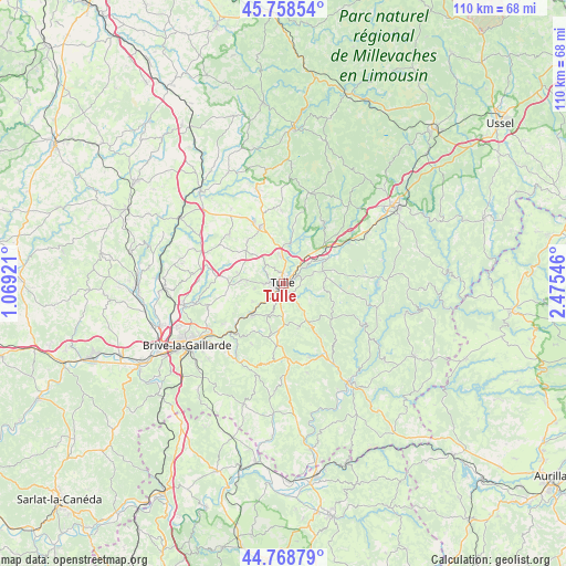
Tulle GPS coordinates[2]
45° 15' 56.952" North, 1° 46' 20.388" East
| Map corner | latitude | longitude |
|---|---|---|
| Upper-left | 45.75854°, | 1.06921° |
| Center: | 45.26582°, | 1.77233° |
| Lower-right: | 44.76879°, | 2.47546° |
| Map W x H: | 110×110 km | = 68.4×68.4mi |
| max Lat: | 51.07786° ⇑76.7% North |
| Tulle: | 45.26582° |
| min Lat: | ⇓23.3% South 41.3874° |
| min Long | Tulle | max Long |
| -5.08615° | 1.77233° | 9.52242° |
| W 40.3%⇐ | ⇒59.7% E |
Elevation
Elevation of Tulle is 307 m = 1007 ft, and this is 113.3 m = 372 ft above average elevation for this country.
| Max E: |
2333 m = 7654 ft | 18.3% |
| Tulle | 307 m 1007 ft | |
| Avg. | 193.7 m = 635 ft | |
Min E: |
-1 m = -3 ft | 81.7% |
See also: France elevation on elevation.city.
Geographical zone
Tulle is located in North temperate zone (between Tropic of Cancer and the Arctic Circle). Distance of this North polar circle is 2368.1 km =1471.5 mi to North.| Distance of | km | miles | from Tulle |
|---|---|---|---|
| North Pole | 4974 | 3090.7 | to North |
| Arctic Circle | 2368.1 | 1471.5 | to North |
| Tropic Cancer | 2427.2 | 1508.2 | to South |
| Equator | 5033.1 | 3127.4 | to South |


Nearby cities:
15 places around Tulle: (largest is in red/bold)
• Aubazine
12.7 km =7.9 mi,  217°
217°
• Chameyrat
6.8 km =4.2 mi,  238°
238°
• Chanac-les-Mines
3.7 km =2.3 mi,  92°
92°
• Chanteix
11.6 km =7.2 mi,  294°
294°
• Cornil
8.8 km =5.5 mi,  225°
225°
• Gimel-les-Cascades
7.2 km =4.5 mi,  58°
58°
• Lagarde-Enval
9.2 km =5.7 mi,  162°
162°
• Laguenne
2.7 km =1.7 mi, 164°
• Naves
5.4 km =3.4 mi,  355°
355°
• Saint-Clément
10.8 km =6.7 mi,  320°
320°
• Saint-Germain-les-Vergnes
10.8 km =6.7 mi,  274°
274°
• Saint-Hilaire-Peyroux
11.3 km =7 mi, 239°
• Saint-Mexant
9.2 km =5.7 mi,  283°
283°
• Sainte-Fortunade
6.6 km =4.1 mi,  180°
180°
• Seilhac
12.2 km =7.6 mi,  337°
337°
Sources, notices
• [Note1] Compared only with cities in France existing in our database
• [Src1] Map data: © OpenStreetMap contributors (CC-BY-SA)
• [Src2] Other city data from geonames.org with taken over terms of usage.
• [Src3] Geographical zone / Annual Mean Temperature by Robert A. Rohde @ Wikipedia
