Seilhac geodata
Seilhac (Nouvelle-Aquitaine) is a populated place; located in France in Europe/Paris (GMT+2) time zone. With population of 1,744 people, there are 5429 cities with bigger population in this country. Compared to other cities in France, 75.6% of cities are located further ↑North; 60.3% of cities are located further →East and 92.7% of cities have lower elevation than Seilhac. Note1
Administrative division(s):
- Level 1: Nouvelle-Aquitaine
- Level 2: Département de la Corrèze
- Level 3: Arrondissement de Tulle
- Level 4: Seilhac


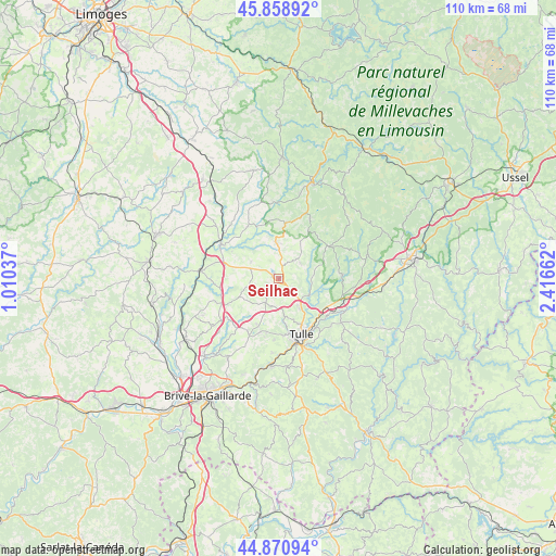
Seilhac GPS coordinates[2]
45° 22' 1.524" North, 1° 42' 48.6" East
| Map corner | latitude | longitude |
|---|---|---|
| Upper-left | 45.85892°, | 1.01037° |
| Center: | 45.36709°, | 1.7135° |
| Lower-right: | 44.87094°, | 2.41662° |
| Map W x H: | 109.9×109.9 km | = 68.3×68.3mi |
| max Lat: | 51.07786° ⇑75.6% North |
| Seilhac: | 45.36709° |
| min Lat: | ⇓24.4% South 41.3874° |
| min Long | Seilhac | max Long |
| -5.08615° | 1.7135° | 9.52242° |
| W 39.7%⇐ | ⇒60.3% E |
Elevation
Elevation of Seilhac is 495 m = 1624 ft, and this is 301.3 m = 989 ft above average elevation for this country.
| Max E: |
2333 m = 7654 ft | 7.3% |
| Seilhac | 495 m 1624 ft | |
| Avg. | 193.7 m = 635 ft | |
Min E: |
-1 m = -3 ft | 92.7% |
See also: France elevation on elevation.city.
Geographical zone
Seilhac is located in North temperate zone (between Tropic of Cancer and the Arctic Circle). Distance of this North polar circle is 2356.8 km =1464.4 mi to North.| Distance of | km | miles | from Seilhac |
|---|---|---|---|
| North Pole | 4962.7 | 3083.7 | to North |
| Arctic Circle | 2356.8 | 1464.4 | to North |
| Tropic Cancer | 2438.4 | 1515.2 | to South |
| Equator | 5044.3 | 3134.4 | to South |


Nearby cities:
15 places around Seilhac: (largest is in red/bold)
• Chamboulive
7.3 km =4.5 mi,  354°
354°
• Chanteix
8.7 km =5.4 mi,  223°
223°
• Corrèze
12.6 km =7.8 mi,  87°
87°
• Eyburie
12 km =7.5 mi,  329°
329°
• Gimel-les-Cascades
13.1 km =8.1 mi,  124°
124°
• Lagraulière
6.1 km =3.8 mi,  254°
254°
• Le Lonzac
10.8 km =6.7 mi,  6°
6°
• Naves
7.2 km =4.5 mi,  144°
144°
• Perpezac-le-Noir
13.4 km =8.3 mi, 250°
• Saint-Clément
3.6 km =2.2 mi, 217°
• Saint-Germain-les-Vergnes
12.1 km =7.5 mi,  210°
210°
• Saint-Jal
6.4 km =4 mi,  300°
300°
• Saint-Mexant
10.1 km =6.3 mi, 205°
• Tulle
12.2 km =7.6 mi,  157°
157°
• Uzerche
13.4 km =8.3 mi, 298°
Sources, notices
• [Note1] Compared only with cities in France existing in our database
• [Src1] Map data: © OpenStreetMap contributors (CC-BY-SA)
• [Src2] Other city data from geonames.org with taken over terms of usage.
• [Src3] Geographical zone / Annual Mean Temperature by Robert A. Rohde @ Wikipedia
