Lagarde-Enval geodata
Lagarde-Enval (Nouvelle-Aquitaine) is a populated place; located in France in Europe/Paris (GMT+2) time zone. With population of 770 people, there are 10937 cities with bigger population in this country. Compared to other cities in France, 77.6% of cities are located further ↑North; 59.3% of cities are located further →East and 92.6% of cities have lower elevation than Lagarde-Enval. Note1
Administrative division(s):
- Level 1: Nouvelle-Aquitaine
- Level 2: Département de la Corrèze
- Level 3: Arrondissement de Tulle
- Level 4: Lagarde-Marc-la-Tour


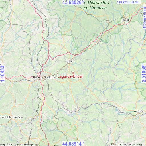
Lagarde-Enval GPS coordinates[2]
45° 11' 12.696" North, 1° 48' 26.856" East
| Map corner | latitude | longitude |
|---|---|---|
| Upper-left | 45.68026°, | 1.10433° |
| Center: | 45.18686°, | 1.80746° |
| Lower-right: | 44.68914°, | 2.51058° |
| Map W x H: | 110.2×110.2 km | = 68.5×68.5mi |
| max Lat: | 51.07786° ⇑77.6% North |
| Lagarde-Enval: | 45.18686° |
| min Lat: | ⇓22.4% South 41.3874° |
| min Long | Lagarde-Enval | max Long |
| -5.08615° | 1.80746° | 9.52242° |
| W 40.7%⇐ | ⇒59.3% E |
Elevation
Elevation of Lagarde-Enval is 492 m = 1614 ft, and this is 298.3 m = 979 ft above average elevation for this country.
| Max E: |
2333 m = 7654 ft | 7.4% |
| Lagarde-Enval | 492 m 1614 ft | |
| Avg. | 193.7 m = 635 ft | |
Min E: |
-1 m = -3 ft | 92.6% |
See also: France elevation on elevation.city.
Geographical zone
Lagarde-Enval is located in North temperate zone (between Tropic of Cancer and the Arctic Circle). Distance of this North polar circle is 2376.9 km =1476.9 mi to North.| Distance of | km | miles | from Lagarde-Enval |
|---|---|---|---|
| North Pole | 4982.8 | 3096.2 | to North |
| Arctic Circle | 2376.9 | 1476.9 | to North |
| Tropic Cancer | 2418.4 | 1502.7 | to South |
| Equator | 5024.3 | 3122 | to South |


Nearby cities:
15 places around Lagarde-Enval: (largest is in red/bold)
• Albussac
5.9 km =3.7 mi,  157°
157°
• Aubazine
10.6 km =6.6 mi,  262°
262°
• Beynat
9.6 km =6 mi,  223°
223°
• Chameyrat
10 km =6.2 mi,  301°
301°
• Chanac-les-Mines
8.7 km =5.4 mi,  6°
6°
• Cornil
9.4 km =5.8 mi,  286°
286°
• Dampniat
13.9 km =8.6 mi, 261°
• Gimel-les-Cascades
13 km =8.1 mi,  15°
15°
• Laguenne
6.5 km =4 mi,  341°
341°
• Monceaux-sur-Dordogne
14.1 km =8.8 mi,  146°
146°
• Naves
14.5 km =9 mi,  347°
347°
• Saint-Chamant
9.7 km =6 mi,  134°
134°
• Saint-Hilaire-Peyroux
12.8 km =8 mi,  283°
283°
• Sainte-Fortunade
3.6 km =2.2 mi,  308°
308°
• Tulle
9.2 km =5.7 mi, 342°
Sources, notices
• [Note1] Compared only with cities in France existing in our database
• [Src1] Map data: © OpenStreetMap contributors (CC-BY-SA)
• [Src2] Other city data from geonames.org with taken over terms of usage.
• [Src3] Geographical zone / Annual Mean Temperature by Robert A. Rohde @ Wikipedia
