Trédaniel geodata
Trédaniel (Brittany) is a populated place; located in France in Europe/Paris (GMT+2) time zone. With population of 895 people, there are 9701 cities with bigger population in this country. Compared to other cities in France, 65.6% of cities are located further ↓South; 96.5% of cities are located further →East and 56.3% of cities have lower elevation than Trédaniel. Note1
Administrative division(s):
- Level 1: Brittany
- Level 2: Département des Côtes-d’Armor
- Level 3: Arrondissement de Saint-Brieuc
- Level 4: Trédaniel


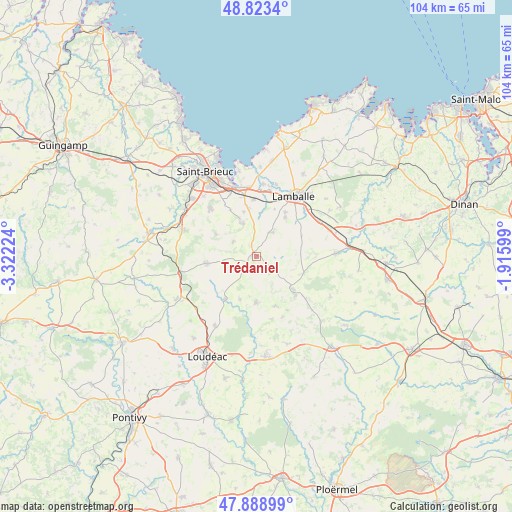
Trédaniel GPS coordinates[2]
48° 21' 30.024" North, 2° 37' 8.796" West
| Map corner | latitude | longitude |
|---|---|---|
| Upper-left | 48.8234°, | -3.32224° |
| Center: | 48.35834°, | -2.61911° |
| Lower-right: | 47.88899°, | -1.91599° |
| Map W x H: | 103.9×103.9 km | = 64.6×64.6mi |
| max Lat: | 51.07786° ⇑34.4% North |
| Trédaniel: | 48.35834° |
| min Lat: | ⇓65.6% South 41.3874° |
| min Long | Trédaniel | max Long |
| -5.08615° | -2.61911° | 9.52242° |
| W 3.5%⇐ | ⇒96.5% E |
Elevation
Elevation of Trédaniel is 155 m = 509 ft, and this is 38.7 m = 127 ft below average elevation for this country.
| Max E: |
2333 m = 7654 ft | 43.7% |
| Avg. | 193.7 m = 635 ft | |
| Trédaniel | 155 m = 509 ft | |
Min E: |
-1 m = -3 ft | 56.3% |
See also: France elevation on elevation.city.
Geographical zone
Trédaniel is located in North temperate zone (between Tropic of Cancer and the Arctic Circle). Distance of this North polar circle is 2024.2 km =1257.8 mi to North.| Distance of | km | miles | from Trédaniel |
|---|---|---|---|
| North Pole | 4630.1 | 2877 | to North |
| Arctic Circle | 2024.2 | 1257.8 | to North |
| Tropic Cancer | 2771 | 1721.8 | to South |
| Equator | 5376.9 | 3341 | to South |


Nearby cities:
15 places around Trédaniel: (largest is in red/bold)
• Bréhand
6 km =3.7 mi,  33°
33°
• Collinée
9.9 km =6.2 mi,  131°
131°
• Hénon
5.6 km =3.5 mi,  301°
301°
• Landéhen
9.9 km =6.2 mi,  36°
36°
• Langast
9.2 km =5.7 mi,  200°
200°
• Le Gouray
10.3 km =6.4 mi,  109°
109°
• Meslin
10.4 km =6.5 mi,  20°
20°
• Moncontour
1 km =0.6 mi,  279°
279°
• Plessala
9.1 km =5.7 mi,  179°
179°
• Plémy
5.3 km =3.3 mi,  242°
242°
• Plœuc-sur-Lié
9.7 km =6 mi,  264°
264°
• Quessoy
7.7 km =4.8 mi,  336°
336°
• Saint-Carreuc
9.4 km =5.8 mi, 298°
• Saint-Glen
7.1 km =4.4 mi,  89°
89°
• Trébry
5 km =3.1 mi, 94°
Sources, notices
• [Note1] Compared only with cities in France existing in our database
• [Src1] Map data: © OpenStreetMap contributors (CC-BY-SA)
• [Src2] Other city data from geonames.org with taken over terms of usage.
• [Src3] Geographical zone / Annual Mean Temperature by Robert A. Rohde @ Wikipedia
