Moncontour geodata
Moncontour (Brittany) is a populated place; located in France in Europe/Paris (GMT+2) time zone. With population of 892 people, there are 9724 cities with bigger population in this country. Compared to other cities in France, 65.7% of cities are located further ↓South; 96.5% of cities are located further →East and 51.2% of cities have higher elevation than Moncontour. Note1
Administrative division(s):
- Level 1: Brittany
- Level 2: Département des Côtes-d’Armor
- Level 3: Arrondissement de Saint-Brieuc
- Level 4: Moncontour


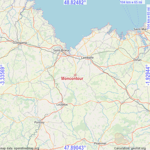
Moncontour GPS coordinates[2]
48° 21' 35.172" North, 2° 37' 57.252" West
| Map corner | latitude | longitude |
|---|---|---|
| Upper-left | 48.82482°, | -3.33569° |
| Center: | 48.35977°, | -2.63257° |
| Lower-right: | 47.89043°, | -1.92944° |
| Map W x H: | 103.9×103.9 km | = 64.6×64.6mi |
| max Lat: | 51.07786° ⇑34.3% North |
| Moncontour: | 48.35977° |
| min Lat: | ⇓65.7% South 41.3874° |
| min Long | Moncontour | max Long |
| -5.08615° | -2.63257° | 9.52242° |
| W 3.5%⇐ | ⇒96.5% E |
Elevation
Elevation of Moncontour is 128 m = 420 ft, and this is 65.7 m = 216 ft below average elevation for this country.
| Max E: |
2333 m = 7654 ft | 51.2% |
| Avg. | 193.7 m = 635 ft | |
| Moncontour | 128 m = 420 ft | |
Min E: |
-1 m = -3 ft | 48.8% |
See also: France elevation on elevation.city.
Geographical zone
Moncontour is located in North temperate zone (between Tropic of Cancer and the Arctic Circle). Distance of this North polar circle is 2024.1 km =1257.7 mi to North.| Distance of | km | miles | from Moncontour |
|---|---|---|---|
| North Pole | 4630 | 2876.9 | to North |
| Arctic Circle | 2024.1 | 1257.7 | to North |
| Tropic Cancer | 2771.2 | 1721.9 | to South |
| Equator | 5377.1 | 3341.2 | to South |


Nearby cities:
15 places around Moncontour: (largest is in red/bold)
• Bréhand
6.5 km =4 mi,  41°
41°
• Collinée
10.8 km =6.7 mi,  128°
128°
• Hénon
4.6 km =2.9 mi,  306°
306°
• Landéhen
10.4 km =6.5 mi, 41°
• Langast
9.1 km =5.7 mi,  194°
194°
• Meslin
10.6 km =6.6 mi,  26°
26°
• Plessala
9.3 km =5.8 mi,  173°
173°
• Plouguenast
10.1 km =6.3 mi,  211°
211°
• Plémy
4.5 km =2.8 mi,  234°
234°
• Plœuc-sur-Lié
8.7 km =5.4 mi,  262°
262°
• Quessoy
7.2 km =4.5 mi,  343°
343°
• Saint-Carreuc
8.4 km =5.2 mi,  301°
301°
• Saint-Glen
8.1 km =5 mi,  91°
91°
• Trébry
6 km =3.7 mi,  95°
95°
• Trédaniel
1 km =0.6 mi, 99°
Sources, notices
• [Note1] Compared only with cities in France existing in our database
• [Src1] Map data: © OpenStreetMap contributors (CC-BY-SA)
• [Src2] Other city data from geonames.org with taken over terms of usage.
• [Src3] Geographical zone / Annual Mean Temperature by Robert A. Rohde @ Wikipedia
