Tramain geodata
Tramain (Brittany) is a populated place; located in France in Europe/Paris (GMT+2) time zone. With population of 546 people, there are 14284 cities with bigger population in this country. Compared to other cities in France, 66.4% of cities are located further ↓South; 96% of cities are located further →East and 57.9% of cities have higher elevation than Tramain. Note1
Administrative division(s):
- Level 1: Brittany
- Level 2: Département des Côtes-d’Armor
- Level 3: Arrondissement de Saint-Brieuc
- Level 4: Tramain


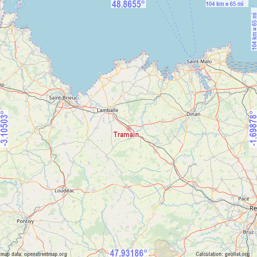
Tramain GPS coordinates[2]
48° 24' 2.952" North, 2° 24' 6.84" West
| Map corner | latitude | longitude |
|---|---|---|
| Upper-left | 48.8655°, | -3.10503° |
| Center: | 48.40082°, | -2.4019° |
| Lower-right: | 47.93186°, | -1.69878° |
| Map W x H: | 103.8×103.8 km | = 64.5×64.5mi |
| max Lat: | 51.07786° ⇑33.6% North |
| Tramain: | 48.40082° |
| min Lat: | ⇓66.4% South 41.3874° |
| min Long | Tramain | max Long |
| -5.08615° | -2.4019° | 9.52242° |
| W 4%⇐ | ⇒96% E |
Elevation
Elevation of Tramain is 108 m = 354 ft, and this is 85.7 m = 281 ft below average elevation for this country.
| Max E: |
2333 m = 7654 ft | 57.9% |
| Avg. | 193.7 m = 635 ft | |
| Tramain | 108 m = 354 ft | |
Min E: |
-1 m = -3 ft | 42.1% |
See also: France elevation on elevation.city.
Geographical zone
Tramain is located in North temperate zone (between Tropic of Cancer and the Arctic Circle). Distance of this North polar circle is 2019.5 km =1254.9 mi to North.| Distance of | km | miles | from Tramain |
|---|---|---|---|
| North Pole | 4625.4 | 2874.1 | to North |
| Arctic Circle | 2019.5 | 1254.9 | to North |
| Tropic Cancer | 2775.7 | 1724.7 | to South |
| Equator | 5381.7 | 3344 | to South |


Nearby cities:
15 places around Tramain: (largest is in red/bold)
• Bréhand
12.7 km =7.9 mi,  271°
271°
• Jugon-les-Lacs
5.4 km =3.4 mi,  70°
70°
• Lamballe
11.1 km =6.9 mi,  311°
311°
• Landéhen
10.7 km =6.6 mi,  287°
287°
• Le Gouray
10.3 km =6.4 mi,  218°
218°
• Mégrit
11.7 km =7.3 mi,  104°
104°
• Noyal
8.1 km =5 mi, 309°
• Plestan
4.2 km =2.6 mi, 305°
• Plédéliac
5.6 km =3.5 mi,  14°
14°
• Plénée-Jugon
4 km =2.5 mi,  178°
178°
• Pléven
11.6 km =7.2 mi,  31°
31°
• Saint-Glen
10.1 km =6.3 mi,  242°
242°
• Sévignac
8.9 km =5.5 mi,  148°
148°
• Trébry
12.2 km =7.6 mi,  245°
245°
• Trémeur
11.8 km =7.3 mi,  120°
120°
Sources, notices
• [Note1] Compared only with cities in France existing in our database
• [Src1] Map data: © OpenStreetMap contributors (CC-BY-SA)
• [Src2] Other city data from geonames.org with taken over terms of usage.
• [Src3] Geographical zone / Annual Mean Temperature by Robert A. Rohde @ Wikipedia
