Charrin geodata
Charrin (Bourgogne-Franche-Comté) is a populated place; located in France in Europe/Paris (GMT+2) time zone. With population of 626 people, there are 12883 cities with bigger population in this country. Compared to other cities in France, 57.3% of cities are located further ↑North; 65% of cities are located further ←West and 65.6% of cities have lower elevation than Charrin. Note1
Administrative division(s):
- Level 1: Bourgogne-Franche-Comté
- Level 2: Département de la Nièvre
- Level 3: Arrondissement de Château-Chinon (Ville)
- Level 4: Charrin


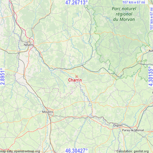
Charrin GPS coordinates[2]
46° 47' 16.26" North, 3° 35' 53.592" East
| Map corner | latitude | longitude |
|---|---|---|
| Upper-left | 47.26713°, | 2.8951° |
| Center: | 46.78785°, | 3.59822° |
| Lower-right: | 46.30427°, | 4.30135° |
| Map W x H: | 107.1×107.1 km | = 66.5×66.5mi |
| max Lat: | 51.07786° ⇑57.3% North |
| Charrin: | 46.78785° |
| min Lat: | ⇓42.7% South 41.3874° |
| min Long | Charrin | max Long |
| -5.08615° | 3.59822° | 9.52242° |
| W 65%⇐ | ⇒35% E |
Elevation
Elevation of Charrin is 197 m = 646 ft, and this is 3.3 m = 11 ft above average elevation for this country.
| Max E: |
2333 m = 7654 ft | 34.4% |
| Charrin | 197 m 646 ft | |
| Avg. | 193.7 m = 635 ft | |
Min E: |
-1 m = -3 ft | 65.6% |
See also: France elevation on elevation.city.
Geographical zone
Charrin is located in North temperate zone (between Tropic of Cancer and the Arctic Circle). Distance of this North polar circle is 2198.9 km =1366.3 mi to North.| Distance of | km | miles | from Charrin |
|---|---|---|---|
| North Pole | 4804.7 | 2985.5 | to North |
| Arctic Circle | 2198.9 | 1366.3 | to North |
| Tropic Cancer | 2596.4 | 1613.3 | to South |
| Equator | 5202.3 | 3232.6 | to South |


Nearby cities:
15 places around Charrin: (largest is in red/bold)
• Beaulon
21.5 km =13.4 mi,  164°
164°
• Cercy-la-Tour
9 km =5.6 mi,  24°
24°
• Champvert
8.9 km =5.5 mi,  311°
311°
• Chevagnes
20 km =12.4 mi,  190°
190°
• Cossaye
9.7 km =6 mi,  243°
243°
• Cronat
9.9 km =6.2 mi,  137°
137°
• Decize
11.3 km =7 mi,  293°
293°
• Dornes
20.3 km =12.6 mi,  246°
246°
• Fours
9.9 km =6.2 mi,  71°
71°
• Garnat-sur-Engièvre
17.8 km =11.1 mi, 163°
• La Machine
15.4 km =9.6 mi,  318°
318°
• Lucenay-lès-Aix
12.9 km =8 mi,  222°
222°
• Saint-Ennemond
18.3 km =11.4 mi,  227°
227°
• Saint-Léger-des-Vignes
12.4 km =7.7 mi,  298°
298°
• Sougy-sur-Loire
17.5 km =10.9 mi, 295°
Sources, notices
• [Note1] Compared only with cities in France existing in our database
• [Src1] Map data: © OpenStreetMap contributors (CC-BY-SA)
• [Src2] Other city data from geonames.org with taken over terms of usage.
• [Src3] Geographical zone / Annual Mean Temperature by Robert A. Rohde @ Wikipedia
