Sisteron geodata
Sisteron (Provence-Alpes-Côte d'Azur) is a populated place; located in France in Europe/Paris (GMT+2) time zone. With population of 7,605 people, there are 1274 cities with bigger population in this country. Compared to other cities in France, 85.6% of cities are located further ↑North; 86.5% of cities are located further ←West and 91.5% of cities have lower elevation than Sisteron. Note1
Administrative division(s):
- Level 1: Provence-Alpes-Côte d'Azur
- Level 2: Alpes-de-Haute-Provence
- Level 3: Arrondissement de Forcalquier
- Level 4: Sisteron


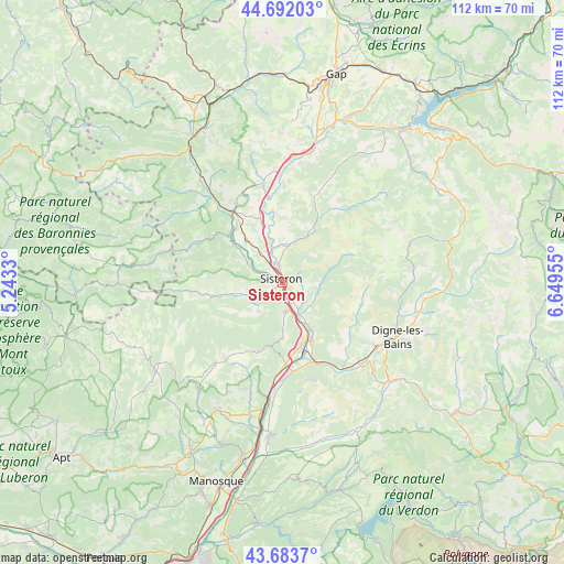
Sisteron GPS coordinates[2]
44° 11' 24.072" North, 5° 56' 47.148" East
| Map corner | latitude | longitude |
|---|---|---|
| Upper-left | 44.69203°, | 5.2433° |
| Center: | 44.19002°, | 5.94643° |
| Lower-right: | 43.6837°, | 6.64955° |
| Map W x H: | 112.1×112.1 km | = 69.7×69.7mi |
| max Lat: | 51.07786° ⇑85.6% North |
| Sisteron: | 44.19002° |
| min Lat: | ⇓14.4% South 41.3874° |
| min Long | Sisteron | max Long |
| -5.08615° | 5.94643° | 9.52242° |
| W 86.5%⇐ | ⇒13.5% E |
Elevation
Elevation of Sisteron is 461 m = 1512 ft, and this is 267.3 m = 877 ft above average elevation for this country.
| Max E: |
2333 m = 7654 ft | 8.5% |
| Sisteron | 461 m 1512 ft | |
| Avg. | 193.7 m = 635 ft | |
Min E: |
-1 m = -3 ft | 91.5% |
See also: France elevation on elevation.city.
Geographical zone
Sisteron is located in North temperate zone (between Tropic of Cancer and the Arctic Circle). Distance of this Northern Tropic circle is 2307.6 km =1433.9 mi to South.| Distance of | km | miles | from Sisteron |
|---|---|---|---|
| North Pole | 5093.6 | 3165 | to North |
| Arctic Circle | 2487.7 | 1545.8 | to North |
| Tropic Cancer | 2307.6 | 1433.9 | to South |
| Equator | 4913.5 | 3053.1 | to South |


Nearby cities:
15 places around Sisteron: (largest is in red/bold)
• Aubignosc
6.9 km =4.3 mi,  165°
165°
• Champtercier
20.1 km =12.5 mi,  121°
121°
• Cruis
16.7 km =10.4 mi,  211°
211°
• La Motte-du-Caire
18.3 km =11.4 mi,  20°
20°
• Laragne-Montéglin
17.5 km =10.9 mi,  323°
323°
• Les Mées
18 km =11.2 mi, 172°
• L’Escale
13.5 km =8.4 mi,  152°
152°
• Malijai
17.4 km =10.8 mi,  157°
157°
• Mison
11.8 km =7.3 mi,  314°
314°
• Peipin
5.9 km =3.7 mi, 171°
• Peyruis
17.9 km =11.1 mi,  181°
181°
• Ribiers
8.5 km =5.3 mi,  302°
302°
• Thoard
16.7 km =10.4 mi,  105°
105°
• Ventavon
20.4 km =12.7 mi,  350°
350°
• Volonne
10.4 km =6.5 mi, 148°
Sources, notices
• [Note1] Compared only with cities in France existing in our database
• [Src1] Map data: © OpenStreetMap contributors (CC-BY-SA)
• [Src2] Other city data from geonames.org with taken over terms of usage.
• [Src3] Geographical zone / Annual Mean Temperature by Robert A. Rohde @ Wikipedia
