La Motte-du-Caire geodata
La Motte-du-Caire (Provence-Alpes-Côte d'Azur) is a populated place; located in France in Europe/Paris (GMT+2) time zone. With population of 517 people, there are 14885 cities with bigger population in this country. Compared to other cities in France, 84.6% of cities are located further ↑North; 87.3% of cities are located further ←West and 96.8% of cities have lower elevation than La Motte-du-Caire. Note1
Administrative division(s):
- Level 1: Provence-Alpes-Côte d'Azur
- Level 2: Alpes-de-Haute-Provence
- Level 3: Arrondissement de Forcalquier
- Level 4: La Motte-du-Caire


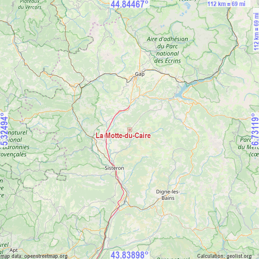
La Motte-du-Caire GPS coordinates[2]
44° 20' 38.328" North, 6° 1' 41.052" East
| Map corner | latitude | longitude |
|---|---|---|
| Upper-left | 44.84467°, | 5.32494° |
| Center: | 44.34398°, | 6.02807° |
| Lower-right: | 43.83898°, | 6.73119° |
| Map W x H: | 111.8×111.8 km | = 69.5×69.5mi |
| max Lat: | 51.07786° ⇑84.6% North |
| La Motte-du-Caire: | 44.34398° |
| min Lat: | ⇓15.4% South 41.3874° |
| min Long | La Motte-du-Cai | max Long |
| -5.08615° | 6.02807° | 9.52242° |
| W 87.3%⇐ | ⇒12.7% E |
Elevation
Elevation of La Motte-du-Caire is 716 m = 2349 ft, and this is 522.3 m = 1714 ft above average elevation for this country.
| Max E: |
2333 m = 7654 ft | 3.2% |
| La Motte-du-Caire | 716 m 2349 ft | |
| Avg. | 193.7 m = 635 ft | |
Min E: |
-1 m = -3 ft | 96.8% |
See also: France elevation on elevation.city.
Geographical zone
La Motte-du-Caire is located in North temperate zone (between Tropic of Cancer and the Arctic Circle). Distance of this Northern Tropic circle is 2324.7 km =1444.5 mi to South.| Distance of | km | miles | from La Motte-du-Caire |
|---|---|---|---|
| North Pole | 5076.5 | 3154.4 | to North |
| Arctic Circle | 2470.6 | 1535.2 | to North |
| Tropic Cancer | 2324.7 | 1444.5 | to South |
| Equator | 4930.6 | 3063.7 | to South |


Nearby cities:
15 places around La Motte-du-Caire: (largest is in red/bold)
• Aubignosc
24.3 km =15.1 mi,  191°
191°
• Espinasses
21.1 km =13.1 mi,  49°
49°
• Gap
24.2 km =15 mi,  9°
9°
• La Roche-des-Arnauds
24.9 km =15.5 mi,  346°
346°
• La Saulce
9.2 km =5.7 mi, 349°
• Laragne-Montéglin
17.1 km =10.6 mi,  259°
259°
• Mison
17.4 km =10.8 mi,  239°
239°
• Neffes
17.9 km =11.1 mi,  358°
358°
• Peipin
23.6 km =14.7 mi, 193°
• Ribiers
18.5 km =11.5 mi,  227°
227°
• Sigoyer
15.5 km =9.6 mi,  344°
344°
• Sisteron
18.3 km =11.4 mi,  200°
200°
• Tallard
13.3 km =8.3 mi, 8°
• Thoard
23.6 km =14.7 mi,  156°
156°
• Ventavon
10.2 km =6.3 mi,  286°
286°
Sources, notices
• [Note1] Compared only with cities in France existing in our database
• [Src1] Map data: © OpenStreetMap contributors (CC-BY-SA)
• [Src2] Other city data from geonames.org with taken over terms of usage.
• [Src3] Geographical zone / Annual Mean Temperature by Robert A. Rohde @ Wikipedia
