Mison geodata
Mison (Provence-Alpes-Côte d'Azur) is a populated place; located in France in Europe/Paris (GMT+2) time zone. With population of 910 people, there are 9574 cities with bigger population in this country. Compared to other cities in France, 85% of cities are located further ↑North; 85.5% of cities are located further ←West and 96% of cities have lower elevation than Mison. Note1
Administrative division(s):
- Level 1: Provence-Alpes-Côte d'Azur
- Level 2: Alpes-de-Haute-Provence
- Level 3: Arrondissement de Forcalquier
- Level 4: Mison


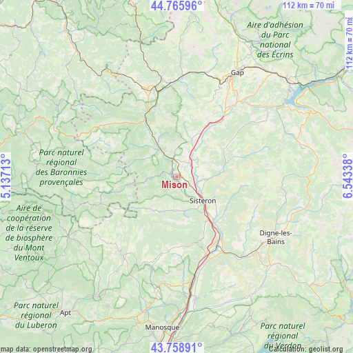
Mison GPS coordinates[2]
44° 15' 52.524" North, 5° 50' 24.9" East
| Map corner | latitude | longitude |
|---|---|---|
| Upper-left | 44.76596°, | 5.13713° |
| Center: | 44.26459°, | 5.84025° |
| Lower-right: | 43.75891°, | 6.54338° |
| Map W x H: | 112×112 km | = 69.6×69.6mi |
| max Lat: | 51.07786° ⇑85% North |
| Mison: | 44.26459° |
| min Lat: | ⇓15% South 41.3874° |
| min Long | Mison | max Long |
| -5.08615° | 5.84025° | 9.52242° |
| W 85.5%⇐ | ⇒14.5% E |
Elevation
Elevation of Mison is 647 m = 2123 ft, and this is 453.3 m = 1487 ft above average elevation for this country.
| Max E: |
2333 m = 7654 ft | 4% |
| Mison | 647 m 2123 ft | |
| Avg. | 193.7 m = 635 ft | |
Min E: |
-1 m = -3 ft | 96% |
See also: France elevation on elevation.city.
Geographical zone
Mison is located in North temperate zone (between Tropic of Cancer and the Arctic Circle). Distance of this Northern Tropic circle is 2315.8 km =1439 mi to South.| Distance of | km | miles | from Mison |
|---|---|---|---|
| North Pole | 5085.3 | 3159.9 | to North |
| Arctic Circle | 2479.4 | 1540.6 | to North |
| Tropic Cancer | 2315.8 | 1439 | to South |
| Equator | 4921.8 | 3058.3 | to South |


Nearby cities:
15 places around Mison: (largest is in red/bold)
• Aubignosc
18.2 km =11.3 mi,  145°
145°
• Cruis
22.5 km =14 mi,  180°
180°
• La Motte-du-Caire
17.4 km =10.8 mi,  59°
59°
• La Saulce
22.3 km =13.9 mi,  36°
36°
• Laragne-Montéglin
6.1 km =3.8 mi,  342°
342°
• L’Escale
25.1 km =15.6 mi,  144°
144°
• Peipin
16.9 km =10.5 mi, 146°
• Peyruis
27.4 km =17 mi,  163°
163°
• Ribiers
3.9 km =2.4 mi, 160°
• Saint-Étienne-les-Orgues
24.9 km =15.5 mi,  191°
191°
• Serres
20.7 km =12.9 mi,  331°
331°
• Sigoyer
26.1 km =16.2 mi,  24°
24°
• Sisteron
11.8 km =7.3 mi,  134°
134°
• Ventavon
12.9 km =8 mi, 23°
• Volonne
22.1 km =13.7 mi, 141°
Sources, notices
• [Note1] Compared only with cities in France existing in our database
• [Src1] Map data: © OpenStreetMap contributors (CC-BY-SA)
• [Src2] Other city data from geonames.org with taken over terms of usage.
• [Src3] Geographical zone / Annual Mean Temperature by Robert A. Rohde @ Wikipedia
