Seyne-les-Alpes geodata
Seyne-les-Alpes (Provence-Alpes-Côte d'Azur) is a populated place; located in France in Europe/Paris (GMT+2) time zone. With population of 1,438 people, there are 6441 cities with bigger population in this country. Compared to other cities in France, 84.6% of cities are located further ↑North; 90.8% of cities are located further ←West and 99.6% of cities have lower elevation than Seyne-les-Alpes. Note1
Administrative division(s):
- Level 1: Provence-Alpes-Côte d'Azur
- Level 2: Alpes-de-Haute-Provence
- Level 3: Arrondissement de Digne-les-Bains
- Level 4: Seyne


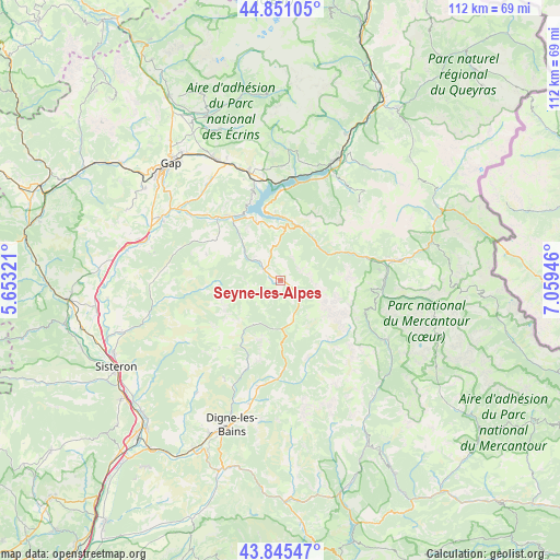
Seyne-les-Alpes GPS coordinates[2]
44° 21' 1.512" North, 6° 21' 22.824" East
| Map corner | latitude | longitude |
|---|---|---|
| Upper-left | 44.85105°, | 5.65321° |
| Center: | 44.35042°, | 6.35634° |
| Lower-right: | 43.84547°, | 7.05946° |
| Map W x H: | 111.8×111.8 km | = 69.5×69.5mi |
| max Lat: | 51.07786° ⇑84.6% North |
| Seyne-les-Alpes: | 44.35042° |
| min Lat: | ⇓15.4% South 41.3874° |
| min Long | Seyne-les-Alpes | max Long |
| -5.08615° | 6.35634° | 9.52242° |
| W 90.8%⇐ | ⇒9.2% E |
Elevation
Elevation of Seyne-les-Alpes is 1189 m = 3901 ft, and this is 995.3 m = 3265 ft above average elevation for this country.
| Max E: |
2333 m = 7654 ft | 0.40000000000001% |
| Seyne-les-Alpes | 1189 m 3901 ft | |
| Avg. | 193.7 m = 635 ft | |
Min E: |
-1 m = -3 ft | 99.6% |
See also: France elevation on elevation.city.
Geographical zone
Seyne-les-Alpes is located in North temperate zone (between Tropic of Cancer and the Arctic Circle). Distance of this Northern Tropic circle is 2325.4 km =1444.9 mi to South.| Distance of | km | miles | from Seyne-les-Alpes |
|---|---|---|---|
| North Pole | 5075.8 | 3154 | to North |
| Arctic Circle | 2469.9 | 1534.7 | to North |
| Tropic Cancer | 2325.4 | 1444.9 | to South |
| Equator | 4931.3 | 3064.2 | to South |


Nearby cities:
15 places around Seyne-les-Alpes: (largest is in red/bold)
• Allos
24.8 km =15.4 mi,  119°
119°
• Barcelonnette
23.8 km =14.8 mi,  80°
80°
• Chorges
22.9 km =14.2 mi,  344°
344°
• Digne-les-Bains
30.3 km =18.8 mi,  199°
199°
• Embrun
26.2 km =16.3 mi,  24°
24°
• Enchastrayes
27 km =16.8 mi,  86°
86°
• Espinasses
16.3 km =10.1 mi,  322°
322°
• Jausiers
30.6 km =19 mi, 75°
• La Bâtie-Neuve
27.2 km =16.9 mi,  332°
332°
• La Motte-du-Caire
26.1 km =16.2 mi,  268°
268°
• La Saulce
29 km =18 mi,  286°
286°
• Le Brusquet
21.4 km =13.3 mi,  190°
190°
• Savines-le-Lac
19.9 km =12.4 mi,  11°
11°
• Tallard
27.2 km =16.9 mi,  297°
297°
• Thoard
27.8 km =17.3 mi,  216°
216°
Sources, notices
• [Note1] Compared only with cities in France existing in our database
• [Src1] Map data: © OpenStreetMap contributors (CC-BY-SA)
• [Src2] Other city data from geonames.org with taken over terms of usage.
• [Src3] Geographical zone / Annual Mean Temperature by Robert A. Rohde @ Wikipedia
