La Saulce geodata
La Saulce (Provence-Alpes-Côte d'Azur) is a populated place; located in France in Europe/Paris (GMT+2) time zone. With population of 976 people, there are 9012 cities with bigger population in this country. Compared to other cities in France, 84.1% of cities are located further ↑North; 87.1% of cities are located further ←West and 94.8% of cities have lower elevation than La Saulce. Note1
Administrative division(s):
- Level 1: Provence-Alpes-Côte d'Azur
- Level 2: Hautes-Alpes
- Level 3: Arrondissement de Gap
- Level 4: La Saulce


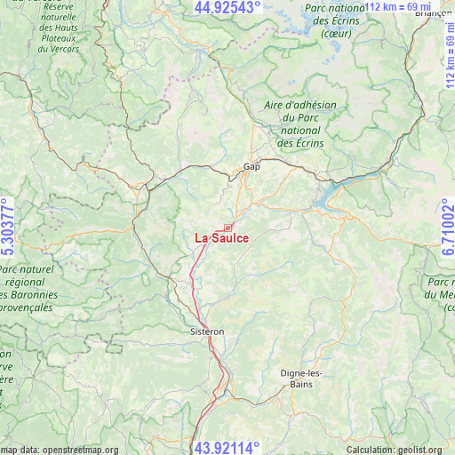
La Saulce GPS coordinates[2]
44° 25' 31.584" North, 6° 0' 24.84" East
| Map corner | latitude | longitude |
|---|---|---|
| Upper-left | 44.92543°, | 5.30377° |
| Center: | 44.42544°, | 6.0069° |
| Lower-right: | 43.92114°, | 6.71002° |
| Map W x H: | 111.7×111.7 km | = 69.4×69.4mi |
| max Lat: | 51.07786° ⇑84.1% North |
| La Saulce: | 44.42544° |
| min Lat: | ⇓15.9% South 41.3874° |
| min Long | La Saulce | max Long |
| -5.08615° | 6.0069° | 9.52242° |
| W 87.1%⇐ | ⇒12.9% E |
Elevation
Elevation of La Saulce is 579 m = 1900 ft, and this is 385.3 m = 1264 ft above average elevation for this country.
| Max E: |
2333 m = 7654 ft | 5.2% |
| La Saulce | 579 m 1900 ft | |
| Avg. | 193.7 m = 635 ft | |
Min E: |
-1 m = -3 ft | 94.8% |
See also: France elevation on elevation.city.
Geographical zone
La Saulce is located in North temperate zone (between Tropic of Cancer and the Arctic Circle). Distance of this Northern Tropic circle is 2333.7 km =1450.1 mi to South.| Distance of | km | miles | from La Saulce |
|---|---|---|---|
| North Pole | 5067.4 | 3148.7 | to North |
| Arctic Circle | 2461.5 | 1529.5 | to North |
| Tropic Cancer | 2333.7 | 1450.1 | to South |
| Equator | 4939.6 | 3069.3 | to South |


Nearby cities:
15 places around La Saulce: (largest is in red/bold)
• Aspres-sur-Buëch
22.9 km =14.2 mi,  298°
298°
• Espinasses
18.3 km =11.4 mi,  75°
75°
• Gap
15.9 km =9.9 mi,  21°
21°
• La Bâtie-Neuve
21.7 km =13.5 mi,  43°
43°
• La Motte-du-Caire
9.2 km =5.7 mi,  169°
169°
• La Roche-des-Arnauds
15.7 km =9.8 mi,  344°
344°
• Laragne-Montéglin
19.4 km =12.1 mi,  231°
231°
• Mison
22.3 km =13.9 mi,  216°
216°
• Neffes
8.9 km =5.5 mi,  7°
7°
• Ribiers
24.7 km =15.3 mi,  208°
208°
• Serres
23.2 km =14.4 mi,  270°
270°
• Sigoyer
6.3 km =3.9 mi, 337°
• Tallard
5.4 km =3.4 mi, 41°
• Ventavon
10.1 km =6.3 mi, 232°
• Veynes
18.9 km =11.7 mi,  309°
309°
Sources, notices
• [Note1] Compared only with cities in France existing in our database
• [Src1] Map data: © OpenStreetMap contributors (CC-BY-SA)
• [Src2] Other city data from geonames.org with taken over terms of usage.
• [Src3] Geographical zone / Annual Mean Temperature by Robert A. Rohde @ Wikipedia
