Oberhoffen-sur-Moder geodata
Oberhoffen-sur-Moder (Grand Est) is a populated place; located in France in Europe/Paris (GMT+2) time zone. With population of 3,119 people, there are 3127 cities with bigger population in this country. Compared to other cities in France, 75.2% of cities are located further ↓South; 99.3% of cities are located further ←West and 51.4% of cities have lower elevation than Oberhoffen-sur-Moder. Note1
Administrative division(s):
- Level 1: Grand Est
- Level 2: Bas-Rhin
- Level 3: Arrondissement de Haguenau-Wissembourg
- Level 4: Oberhoffen-sur-Moder
Current local time in Oberhoffen-sur-Moder:
04:33 AM, WednesdayDifference from your time zone: hours


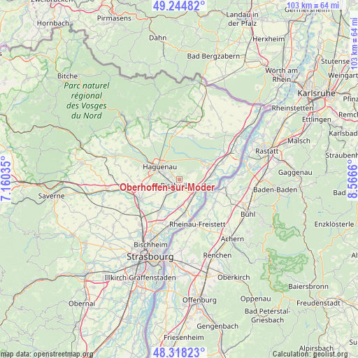
Oberhoffen-sur-Moder GPS coordinates[2]
48° 47' 1.176" North, 7° 51' 48.492" East
| Map corner | latitude | longitude |
|---|---|---|
| Upper-left | 49.24482°, | 7.16035° |
| Center: | 48.78366°, | 7.86347° |
| Lower-right: | 48.31823°, | 8.5666° |
| Map W x H: | 103×103 km | = 64×64mi |
| max Lat: | 51.07786° ⇑24.8% North |
| Oberhoffen-sur-Moder: | 48.78366° |
| min Lat: | ⇓75.2% South 41.3874° |
| min Long | Oberhoffen-sur- | max Long |
| -5.08615° | 7.86347° | 9.52242° |
| W 99.3%⇐ | ⇒0.7% E |
Elevation
Elevation of Oberhoffen-sur-Moder is 137 m = 449 ft, and this is 56.7 m = 186 ft below average elevation for this country.
| Max E: |
2333 m = 7654 ft | 48.6% |
| Avg. | 193.7 m = 635 ft | |
| Oberhoffen-sur-Moder | 137 m = 449 ft | |
Min E: |
-1 m = -3 ft | 51.4% |
See also: France elevation on elevation.city.
Geographical zone
Oberhoffen-sur-Moder is located in North temperate zone (between Tropic of Cancer and the Arctic Circle). Distance of this North polar circle is 1976.9 km =1228.4 mi to North.| Distance of | km | miles | from Oberhoffen-sur-Moder |
|---|---|---|---|
| North Pole | 4582.8 | 2847.6 | to North |
| Arctic Circle | 1976.9 | 1228.4 | to North |
| Tropic Cancer | 2818.3 | 1751.2 | to South |
| Equator | 5424.2 | 3370.4 | to South |


Nearby cities:
15 places around Oberhoffen-sur-Moder: (largest is in red/bold)
• Bischwiller
1.8 km =1.1 mi,  201°
201°
• Drusenheim
7 km =4.3 mi,  110°
110°
• Gambsheim
10.3 km =6.4 mi,  172°
172°
• Gries
4.9 km =3 mi,  227°
227°
• Haguenau
6.4 km =4 mi,  303°
303°
• Herrlisheim
6.7 km =4.2 mi,  152°
152°
• Kaltenhouse
2.4 km =1.5 mi,  289°
289°
• Kriegsheim
10.3 km =6.4 mi,  253°
253°
• Kurtzenhouse
6.5 km =4 mi,  221°
221°
• Niederschaeffolsheim
9.2 km =5.7 mi,  262°
262°
• Schirrhein
3.7 km =2.3 mi,  57°
57°
• Sessenheim
9.2 km =5.7 mi,  81°
81°
• Soufflenheim
8.9 km =5.5 mi,  54°
54°
• Weitbruch
7 km =4.3 mi,  242°
242°
• Weyersheim
8.8 km =5.5 mi,  211°
211°
Sources, notices
• [Note1] Compared only with cities in France existing in our database
• [Src1] Map data: © OpenStreetMap contributors (CC-BY-SA)
• [Src2] Other city data from geonames.org with taken over terms of usage.
• [Src3] Geographical zone / Annual Mean Temperature by Robert A. Rohde @ Wikipedia
