Dragey-Ronthon geodata
Dragey-Ronthon (Normandy) is a populated place; located in France in Europe/Paris (GMT+2) time zone. With population of 629 people, there are 12831 cities with bigger population in this country. Compared to other cities in France, 73.6% of cities are located further ↓South; 92.3% of cities are located further →East and 85.9% of cities have higher elevation than Dragey-Ronthon. Note1
Administrative division(s):
- Level 1: Normandy
- Level 2: Manche
- Level 3: Avranches
- Level 4: Dragey-Ronthon


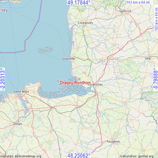
Dragey-Ronthon GPS coordinates[2]
48° 43' 0.012" North, 1° 30' 0" West
| Map corner | latitude | longitude |
|---|---|---|
| Upper-left | 49.17844°, | -2.20313° |
| Center: | 48.71667°, | -1.5° |
| Lower-right: | 48.25062°, | -0.79688° |
| Map W x H: | 103.2×103.2 km | = 64.1×64.1mi |
| max Lat: | 51.07786° ⇑26.4% North |
| Dragey-Ronthon: | 48.71667° |
| min Lat: | ⇓73.6% South 41.3874° |
| min Long | Dragey-Ronthon | max Long |
| -5.08615° | -1.5° | 9.52242° |
| W 7.7%⇐ | ⇒92.3% E |
Elevation
Elevation of Dragey-Ronthon is 40 m = 131 ft, and this is 153.7 m = 504 ft below average elevation for this country.
| Max E: |
2333 m = 7654 ft | 85.9% |
| Avg. | 193.7 m = 635 ft | |
| Dragey-Ronthon | 40 m = 131 ft | |
Min E: |
-1 m = -3 ft | 14.1% |
See also: France elevation on elevation.city.
Geographical zone
Dragey-Ronthon is located in North temperate zone (between Tropic of Cancer and the Arctic Circle). Distance of this North polar circle is 1984.4 km =1233 mi to North.| Distance of | km | miles | from Dragey-Ronthon |
|---|---|---|---|
| North Pole | 4590.3 | 2852.3 | to North |
| Arctic Circle | 1984.4 | 1233 | to North |
| Tropic Cancer | 2810.9 | 1746.6 | to South |
| Equator | 5416.8 | 3365.8 | to South |


Nearby cities:
15 places around Dragey-Ronthon: (largest is in red/bold)
• Avranches
11.1 km =6.9 mi,  108°
108°
• Bacilly
4.7 km =2.9 mi, 111°
• Carolles
5.8 km =3.6 mi,  310°
310°
• Jullouville
8.1 km =5 mi,  324°
324°
• La Haye-Pesnel
11.6 km =7.2 mi,  40°
40°
• Le Val-Saint-Père
10.9 km =6.8 mi,  123°
123°
• Lolif
8.1 km =5 mi,  76°
76°
• Marcey-les-Grèves
8.3 km =5.2 mi, 105°
• Saint-Jean-des-Champs
12.6 km =7.8 mi,  11°
11°
• Saint-Martin-des-Champs
13.3 km =8.3 mi, 113°
• Saint-Pair-sur-Mer
12 km =7.5 mi,  335°
335°
• Saint-Planchers
11.9 km =7.4 mi,  350°
350°
• Saint-Senier-sous-Avranches
12.9 km =8 mi, 106°
• Sartilly
5.1 km =3.2 mi, 38°
• Vains
7.5 km =4.7 mi, 122°
Sources, notices
• [Note1] Compared only with cities in France existing in our database
• [Src1] Map data: © OpenStreetMap contributors (CC-BY-SA)
• [Src2] Other city data from geonames.org with taken over terms of usage.
• [Src3] Geographical zone / Annual Mean Temperature by Robert A. Rohde @ Wikipedia
