Sardent geodata
Sardent (Nouvelle-Aquitaine) is a populated place; located in France in Europe/Paris (GMT+2) time zone. With population of 811 people, there are 10468 cities with bigger population in this country. Compared to other cities in France, 65.7% of cities are located further ↑North; 58.8% of cities are located further →East and 94% of cities have lower elevation than Sardent. Note1
Administrative division(s):
- Level 1: Nouvelle-Aquitaine
- Level 2: Creuse
- Level 3: Arrondissement de Guéret
- Level 4: Sardent


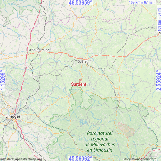
Sardent GPS coordinates[2]
46° 3' 2.736" North, 1° 51' 21.996" East
| Map corner | latitude | longitude |
|---|---|---|
| Upper-left | 46.53659°, | 1.15299° |
| Center: | 46.05076°, | 1.85611° |
| Lower-right: | 45.56062°, | 2.55924° |
| Map W x H: | 108.5×108.5 km | = 67.4×67.4mi |
| max Lat: | 51.07786° ⇑65.7% North |
| Sardent: | 46.05076° |
| min Lat: | ⇓34.3% South 41.3874° |
| min Long | Sardent | max Long |
| -5.08615° | 1.85611° | 9.52242° |
| W 41.2%⇐ | ⇒58.8% E |
Elevation
Elevation of Sardent is 541 m = 1775 ft, and this is 347.3 m = 1139 ft above average elevation for this country.
| Max E: |
2333 m = 7654 ft | 6% |
| Sardent | 541 m 1775 ft | |
| Avg. | 193.7 m = 635 ft | |
Min E: |
-1 m = -3 ft | 94% |
See also: France elevation on elevation.city.
Geographical zone
Sardent is located in North temperate zone (between Tropic of Cancer and the Arctic Circle). Distance of this North polar circle is 2280.8 km =1417.2 mi to North.| Distance of | km | miles | from Sardent |
|---|---|---|---|
| North Pole | 4886.7 | 3036.5 | to North |
| Arctic Circle | 2280.8 | 1417.2 | to North |
| Tropic Cancer | 2514.4 | 1562.4 | to South |
| Equator | 5120.4 | 3181.7 | to South |


Nearby cities:
15 places around Sardent: (largest is in red/bold)
• Ahun
15.1 km =9.4 mi,  75°
75°
• Bourganeuf
13.3 km =8.3 mi,  215°
215°
• Bénévent-l’Abbaye
19.1 km =11.9 mi,  292°
292°
• Glénic
19.9 km =12.4 mi,  14°
14°
• Guéret
13.5 km =8.4 mi, 5°
• La Saunière
10.8 km =6.7 mi,  34°
34°
• Lavaveix-les-Mines
18.1 km =11.2 mi, 82°
• Mourioux-Vieilleville
16.3 km =10.1 mi,  282°
282°
• Pionnat
18.6 km =11.6 mi,  44°
44°
• Saint-Dizier-Leyrenne
11.4 km =7.1 mi,  258°
258°
• Saint-Fiel
18.4 km =11.4 mi, 9°
• Saint-Laurent
15.2 km =9.4 mi, 33°
• Saint-Sulpice-le-Guérétois
16.8 km =10.4 mi,  352°
352°
• Saint-Vaury
18.7 km =11.6 mi,  335°
335°
• Sainte-Feyre
10.8 km =6.7 mi,  24°
24°
Sources, notices
• [Note1] Compared only with cities in France existing in our database
• [Src1] Map data: © OpenStreetMap contributors (CC-BY-SA)
• [Src2] Other city data from geonames.org with taken over terms of usage.
• [Src3] Geographical zone / Annual Mean Temperature by Robert A. Rohde @ Wikipedia
