Sammarçolles geodata
Sammarçolles (Nouvelle-Aquitaine) is a populated place; located in France in Europe/Paris (GMT+2) time zone. With population of 548 people, there are 14246 cities with bigger population in this country. Compared to other cities in France, 54.9% of cities are located further ↑North; 76.8% of cities are located further →East and 64.4% of cities have higher elevation than Sammarçolles. Note1
Administrative division(s):
- Level 1: Nouvelle-Aquitaine
- Level 2: Vienne
- Level 3: Arrondissement de Châtellerault
- Level 4: Sammarçolles


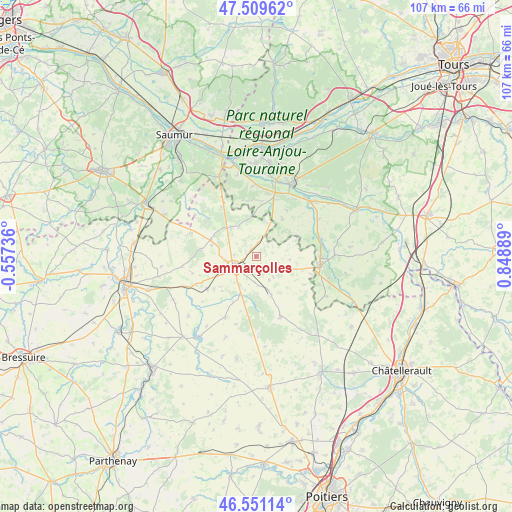
Sammarçolles GPS coordinates[2]
47° 1' 57.108" North, 0° 8' 44.772" East
| Map corner | latitude | longitude |
|---|---|---|
| Upper-left | 47.50962°, | -0.55736° |
| Center: | 47.03253°, | 0.14577° |
| Lower-right: | 46.55114°, | 0.84889° |
| Map W x H: | 106.6×106.6 km | = 66.2×66.2mi |
| max Lat: | 51.07786° ⇑54.9% North |
| Sammarçolles: | 47.03253° |
| min Lat: | ⇓45.1% South 41.3874° |
| min Long | Sammarçolles | max Long |
| -5.08615° | 0.14577° | 9.52242° |
| W 23.2%⇐ | ⇒76.8% E |
Elevation
Elevation of Sammarçolles is 91 m = 299 ft, and this is 102.7 m = 337 ft below average elevation for this country.
| Max E: |
2333 m = 7654 ft | 64.4% |
| Avg. | 193.7 m = 635 ft | |
| Sammarçolles | 91 m = 299 ft | |
Min E: |
-1 m = -3 ft | 35.6% |
See also: France elevation on elevation.city.
Geographical zone
Sammarçolles is located in North temperate zone (between Tropic of Cancer and the Arctic Circle). Distance of this North polar circle is 2171.6 km =1349.4 mi to North.| Distance of | km | miles | from Sammarçolles |
|---|---|---|---|
| North Pole | 4777.5 | 2968.6 | to North |
| Arctic Circle | 2171.6 | 1349.4 | to North |
| Tropic Cancer | 2623.6 | 1630.2 | to South |
| Equator | 5229.5 | 3249.5 | to South |


Nearby cities:
15 places around Sammarçolles: (largest is in red/bold)
• Angliers
9.8 km =6.1 mi,  193°
193°
• Beuxes
7.3 km =4.5 mi,  20°
20°
• Ceaux-en-Loudun
7.1 km =4.4 mi,  95°
95°
• Chalais
8.1 km =5 mi,  213°
213°
• Champigny-sur-Veude
14.3 km =8.9 mi,  75°
75°
• Chaveignes
15.5 km =9.6 mi,  87°
87°
• La Roche-Clermault
12.5 km =7.8 mi, 21°
• Les Trois-Moutiers
10.1 km =6.3 mi,  289°
289°
• Ligré
13.2 km =8.2 mi,  48°
48°
• Loudun
5.5 km =3.4 mi,  240°
240°
• Monts-sur-Guesnes
13.6 km =8.5 mi,  158°
158°
• Mouterre-Silly
10 km =6.2 mi,  230°
230°
• Pouant
10 km =6.2 mi,  107°
107°
• Richelieu
13.7 km =8.5 mi, 98°
• Roiffé
12.4 km =7.7 mi,  325°
325°
Sources, notices
• [Note1] Compared only with cities in France existing in our database
• [Src1] Map data: © OpenStreetMap contributors (CC-BY-SA)
• [Src2] Other city data from geonames.org with taken over terms of usage.
• [Src3] Geographical zone / Annual Mean Temperature by Robert A. Rohde @ Wikipedia
