La Roche-Clermault geodata
La Roche-Clermault (Centre) is a populated place; located in France in Europe/Paris (GMT+2) time zone. With population of 535 people, there are 14511 cities with bigger population in this country. Compared to other cities in France, 53.8% of cities are located further ↑North; 76.2% of cities are located further →East and 78.6% of cities have higher elevation than La Roche-Clermault. Note1
Administrative division(s):
- Level 1: Centre
- Level 2: Département d'Indre-et-Loire
- Level 3: Arrondissement de Chinon
- Level 4: La Roche-Clermault


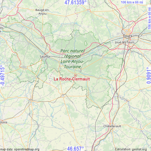
La Roche-Clermault GPS coordinates[2]
47° 8' 14.82" North, 0° 12' 21.492" East
| Map corner | latitude | longitude |
|---|---|---|
| Upper-left | 47.61359°, | -0.49715° |
| Center: | 47.13745°, | 0.20597° |
| Lower-right: | 46.657°, | 0.9091° |
| Map W x H: | 106.4×106.4 km | = 66.1×66.1mi |
| max Lat: | 51.07786° ⇑53.8% North |
| La Roche-Clermault: | 47.13745° |
| min Lat: | ⇓46.2% South 41.3874° |
| min Long | La Roche-Clerma | max Long |
| -5.08615° | 0.20597° | 9.52242° |
| W 23.8%⇐ | ⇒76.2% E |
Elevation
Elevation of La Roche-Clermault is 58 m = 190 ft, and this is 135.7 m = 445 ft below average elevation for this country.
| Max E: |
2333 m = 7654 ft | 78.6% |
| Avg. | 193.7 m = 635 ft | |
| La Roche-Clermault | 58 m = 190 ft | |
Min E: |
-1 m = -3 ft | 21.4% |
See also: France elevation on elevation.city.
Geographical zone
La Roche-Clermault is located in North temperate zone (between Tropic of Cancer and the Arctic Circle). Distance of this North polar circle is 2160 km =1342.2 mi to North.| Distance of | km | miles | from La Roche-Clermault |
|---|---|---|---|
| North Pole | 4765.9 | 2961.4 | to North |
| Arctic Circle | 2160 | 1342.2 | to North |
| Tropic Cancer | 2635.3 | 1637.5 | to South |
| Equator | 5241.2 | 3256.7 | to South |


Nearby cities:
15 places around La Roche-Clermault: (largest is in red/bold)
• Avoine
7.8 km =4.8 mi,  346°
346°
• Beaumont-en-Véron
6.5 km =4 mi, 345°
• Beuxes
5.2 km =3.2 mi,  202°
202°
• Ceaux-en-Loudun
12.6 km =7.8 mi,  168°
168°
• Champigny-sur-Veude
12.3 km =7.6 mi,  130°
130°
• Chinon
4.3 km =2.7 mi,  40°
40°
• Chouzé-sur-Loire
12.7 km =7.9 mi,  330°
330°
• Cravant-les-Coteaux
10.9 km =6.8 mi,  77°
77°
• Huismes
11.2 km =7 mi,  17°
17°
• La Chapelle-sur-Loire
12.6 km =7.8 mi,  4°
4°
• Ligré
6 km =3.7 mi,  118°
118°
• Rivière
5.5 km =3.4 mi, 80°
• Roiffé
11.7 km =7.3 mi,  262°
262°
• Sammarçolles
12.5 km =7.8 mi, 201°
• Savigny-en-Véron
8.4 km =5.2 mi, 326°
Sources, notices
• [Note1] Compared only with cities in France existing in our database
• [Src1] Map data: © OpenStreetMap contributors (CC-BY-SA)
• [Src2] Other city data from geonames.org with taken over terms of usage.
• [Src3] Geographical zone / Annual Mean Temperature by Robert A. Rohde @ Wikipedia
