Saint-Vincent-la-Châtre geodata
Saint-Vincent-la-Châtre (Nouvelle-Aquitaine) is a populated place; located in France in Europe/Paris (GMT+2) time zone. With population of 589 people, there are 13496 cities with bigger population in this country. Compared to other cities in France, 63.2% of cities are located further ↑North; 78.4% of cities are located further →East and 59.6% of cities have lower elevation than Saint-Vincent-la-Châtre. Note1
Administrative division(s):
- Level 1: Nouvelle-Aquitaine
- Level 2: Département des Deux-Sèvres
- Level 3: Arrondissement de Niort
- Level 4: Saint-Vincent-la-Châtre
Current local time in Saint-Vincent-la-Châtre:
02:44 PM, SaturdayDifference from your time zone: hours


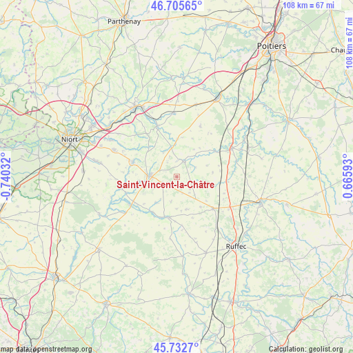
Saint-Vincent-la-Châtre GPS coordinates[2]
46° 13' 16.788" North, 0° 2' 13.884" West
| Map corner | latitude | longitude |
|---|---|---|
| Upper-left | 46.70565°, | -0.74032° |
| Center: | 46.22133°, | -0.03719° |
| Lower-right: | 45.7327°, | 0.66593° |
| Map W x H: | 108.2×108.2 km | = 67.2×67.2mi |
| max Lat: | 51.07786° ⇑63.2% North |
| Saint-Vincent-la-Châtre: | 46.22133° |
| min Lat: | ⇓36.8% South 41.3874° |
| min Long | Saint-Vincent-l | max Long |
| -5.08615° | -0.03719° | 9.52242° |
| W 21.6%⇐ | ⇒78.4% E |
Elevation
Elevation of Saint-Vincent-la-Châtre is 168 m = 551 ft, and this is 25.7 m = 84 ft below average elevation for this country.
| Max E: |
2333 m = 7654 ft | 40.4% |
| Avg. | 193.7 m = 635 ft | |
| Saint-Vincent-la-Châtre | 168 m = 551 ft | |
Min E: |
-1 m = -3 ft | 59.6% |
See also: France elevation on elevation.city.
Geographical zone
Saint-Vincent-la-Châtre is located in North temperate zone (between Tropic of Cancer and the Arctic Circle). Distance of this North polar circle is 2261.8 km =1405.4 mi to North.| Distance of | km | miles | from Saint-Vincent-la-Châtre |
|---|---|---|---|
| North Pole | 4867.7 | 3024.6 | to North |
| Arctic Circle | 2261.8 | 1405.4 | to North |
| Tropic Cancer | 2533.4 | 1574.2 | to South |
| Equator | 5139.3 | 3193.4 | to South |


Nearby cities:
15 places around Saint-Vincent-la-Châtre: (largest is in red/bold)
• Celles-sur-Belle
14.2 km =8.8 mi,  288°
288°
• Chef-Boutonne
12.7 km =7.9 mi,  191°
191°
• Chenay
11.6 km =7.2 mi,  1°
1°
• Chey
9.3 km =5.8 mi,  353°
353°
• Clussais
7.1 km =4.4 mi,  113°
113°
• Exoudun
14.1 km =8.8 mi, 345°
• Fontenille-Saint-Martin-d'Entraigues
13.8 km =8.6 mi,  212°
212°
• Gournay-Loizé
8 km =5 mi, 187°
• Lezay
5.3 km =3.3 mi,  24°
24°
• Melle
8.2 km =5.1 mi,  272°
272°
• Melleran
10.4 km =6.5 mi,  163°
163°
• Rom
14.2 km =8.8 mi,  55°
55°
• Saint-Martin-lès-Melle
9.8 km =6.1 mi, 269°
• Saint-Romans-lès-Melle
11.8 km =7.3 mi,  262°
262°
• Vitré
14.1 km =8.8 mi,  298°
298°
Sources, notices
• [Note1] Compared only with cities in France existing in our database
• [Src1] Map data: © OpenStreetMap contributors (CC-BY-SA)
• [Src2] Other city data from geonames.org with taken over terms of usage.
• [Src3] Geographical zone / Annual Mean Temperature by Robert A. Rohde @ Wikipedia
