Pragoulin geodata
Pragoulin (Auvergne-Rhône-Alpes) is a populated place; located in France in Europe/Paris (GMT+2) time zone. With population of 1,131 people, there are 7936 cities with bigger population in this country. Compared to other cities in France, 65.7% of cities are located further ↑North; 63.1% of cities are located further ←West and 83.6% of cities have lower elevation than Pragoulin. Note1
Administrative division(s):
- Level 1: Auvergne-Rhône-Alpes
- Level 2: Département du Puy-de-Dôme
- Level 3: Arrondissement de Riom
- Level 4: Saint-Sylvestre-Pragoulin


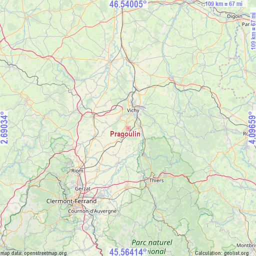
Pragoulin GPS coordinates[2]
46° 3' 15.3" North, 3° 23' 36.456" East
| Map corner | latitude | longitude |
|---|---|---|
| Upper-left | 46.54005°, | 2.69034° |
| Center: | 46.05425°, | 3.39346° |
| Lower-right: | 45.56414°, | 4.09659° |
| Map W x H: | 108.5×108.5 km | = 67.4×67.4mi |
| max Lat: | 51.07786° ⇑65.7% North |
| Pragoulin: | 46.05425° |
| min Lat: | ⇓34.3% South 41.3874° |
| min Long | Pragoulin | max Long |
| -5.08615° | 3.39346° | 9.52242° |
| W 63.1%⇐ | ⇒36.9% E |
Elevation
Elevation of Pragoulin is 330 m = 1083 ft, and this is 136.3 m = 447 ft above average elevation for this country.
| Max E: |
2333 m = 7654 ft | 16.4% |
| Pragoulin | 330 m 1083 ft | |
| Avg. | 193.7 m = 635 ft | |
Min E: |
-1 m = -3 ft | 83.6% |
See also: France elevation on elevation.city.
Geographical zone
Pragoulin is located in North temperate zone (between Tropic of Cancer and the Arctic Circle). Distance of this North polar circle is 2280.4 km =1417 mi to North.| Distance of | km | miles | from Pragoulin |
|---|---|---|---|
| North Pole | 4886.3 | 3036.2 | to North |
| Arctic Circle | 2280.4 | 1417 | to North |
| Tropic Cancer | 2514.8 | 1562.6 | to South |
| Equator | 5120.8 | 3181.9 | to South |


Nearby cities:
15 places around Pragoulin: (largest is in red/bold)
• Abrest
6.3 km =3.9 mi,  38°
38°
• Bellerive-sur-Allier
7 km =4.3 mi,  6°
6°
• Biozat
9.7 km =6 mi,  285°
285°
• Brugheas
3.2 km =2 mi,  321°
321°
• Busset
9.2 km =5.7 mi,  84°
84°
• Cognat-Lyonne
8.8 km =5.5 mi,  313°
313°
• Espinasse-Vozelle
9.6 km =6 mi,  326°
326°
• Hauterive
5.6 km =3.5 mi,  47°
47°
• Limons
9.8 km =6.1 mi,  155°
155°
• Mariol
8.8 km =5.5 mi,  115°
115°
• Randan
5 km =3.1 mi,  216°
216°
• Saint-Priest-Bramefant
4.6 km =2.9 mi,  127°
127°
• Saint-Yorre
5.6 km =3.5 mi, 76°
• Serbannes
5.6 km =3.5 mi, 331°
• Vichy
8.5 km =5.3 mi,  17°
17°
Sources, notices
• [Note1] Compared only with cities in France existing in our database
• [Src1] Map data: © OpenStreetMap contributors (CC-BY-SA)
• [Src2] Other city data from geonames.org with taken over terms of usage.
• [Src3] Geographical zone / Annual Mean Temperature by Robert A. Rohde @ Wikipedia
