Saint-Nom-la-Bretêche geodata
Saint-Nom-la-Bretêche (Île-de-France) is a populated place; located in France in Europe/Paris (GMT+2) time zone. With population of 4,828 people, there are 2052 cities with bigger population in this country. Compared to other cities in France, 76.8% of cities are located further ↓South; 56.9% of cities are located further →East and 52.2% of cities have lower elevation than Saint-Nom-la-Bretêche. Note1
Administrative division(s):
- Level 1: Île-de-France
- Level 2: Yvelines
- Level 3: Arrondissement de Saint-Germain-en-Laye
- Level 4: Saint-Nom-la-Bretèche


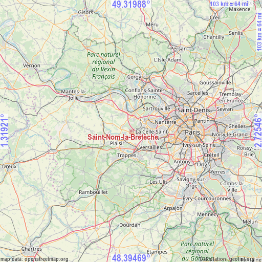
Saint-Nom-la-Bretêche GPS coordinates[2]
48° 51' 33.912" North, 2° 1' 20.388" East
| Map corner | latitude | longitude |
|---|---|---|
| Upper-left | 49.31988°, | 1.31921° |
| Center: | 48.85942°, | 2.02233° |
| Lower-right: | 48.39469°, | 2.72546° |
| Map W x H: | 102.9×102.9 km | = 63.9×63.9mi |
| max Lat: | 51.07786° ⇑23.2% North |
| Saint-Nom-la-Bretêche: | 48.85942° |
| min Lat: | ⇓76.8% South 41.3874° |
| min Long | Saint-Nom-la-Br | max Long |
| -5.08615° | 2.02233° | 9.52242° |
| W 43.1%⇐ | ⇒56.9% E |
Elevation
Elevation of Saint-Nom-la-Bretêche is 140 m = 459 ft, and this is 53.7 m = 176 ft below average elevation for this country.
| Max E: |
2333 m = 7654 ft | 47.8% |
| Avg. | 193.7 m = 635 ft | |
| Saint-Nom-la-Bretêche | 140 m = 459 ft | |
Min E: |
-1 m = -3 ft | 52.2% |
See also: France elevation on elevation.city.
Geographical zone
Saint-Nom-la-Bretêche is located in North temperate zone (between Tropic of Cancer and the Arctic Circle). Distance of this North polar circle is 1968.5 km =1223.2 mi to North.| Distance of | km | miles | from Saint-Nom-la-Bretêche |
|---|---|---|---|
| North Pole | 4574.4 | 2842.4 | to North |
| Arctic Circle | 1968.5 | 1223.2 | to North |
| Tropic Cancer | 2826.7 | 1756.4 | to South |
| Equator | 5432.7 | 3375.7 | to South |


Nearby cities:
15 places around Saint-Nom-la-Bretêche: (largest is in red/bold)
• Aigremont
5 km =3.1 mi,  357°
357°
• Bailly
4.4 km =2.7 mi,  116°
116°
• Chambourcy
5.4 km =3.4 mi,  14°
14°
• Chavenay
2.3 km =1.4 mi,  255°
255°
• Feucherolles
3.7 km =2.3 mi,  288°
288°
• Fontenay-le-Fleury
5.6 km =3.5 mi,  159°
159°
• Fourqueux
4.3 km =2.7 mi,  44°
44°
• Les Clayes-sous-Bois
4.9 km =3 mi,  212°
212°
• L’Étang-la-Ville
2.8 km =1.7 mi,  66°
66°
• Mareil-Marly
4.5 km =2.8 mi,  55°
55°
• Marly-le-Roi
4.5 km =2.8 mi,  79°
79°
• Noisy-le-Roi
3.4 km =2.1 mi, 118°
• Plaisir
6.4 km =4 mi,  231°
231°
• Rocquencourt
6.3 km =3.9 mi,  112°
112°
• Villepreux
3.9 km =2.4 mi, 207°
Sources, notices
• [Note1] Compared only with cities in France existing in our database
• [Src1] Map data: © OpenStreetMap contributors (CC-BY-SA)
• [Src2] Other city data from geonames.org with taken over terms of usage.
• [Src3] Geographical zone / Annual Mean Temperature by Robert A. Rohde @ Wikipedia
