Chavenay geodata
Chavenay (Île-de-France) is a populated place; located in France in Europe/Paris (GMT+2) time zone. With population of 1,850 people, there are 5125 cities with bigger population in this country. Compared to other cities in France, 76.7% of cities are located further ↓South; 57.3% of cities are located further →East and 55.2% of cities have higher elevation than Chavenay. Note1
Administrative division(s):
- Level 1: Île-de-France
- Level 2: Yvelines
- Level 3: Arrondissement de Saint-Germain-en-Laye
- Level 4: Chavenay


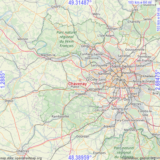
Chavenay GPS coordinates[2]
48° 51' 15.732" North, 1° 59' 29.868" East
| Map corner | latitude | longitude |
|---|---|---|
| Upper-left | 49.31487°, | 1.2885° |
| Center: | 48.85437°, | 1.99163° |
| Lower-right: | 48.38959°, | 2.69475° |
| Map W x H: | 102.9×102.9 km | = 63.9×63.9mi |
| max Lat: | 51.07786° ⇑23.3% North |
| Chavenay: | 48.85437° |
| min Lat: | ⇓76.7% South 41.3874° |
| min Long | Chavenay | max Long |
| -5.08615° | 1.99163° | 9.52242° |
| W 42.7%⇐ | ⇒57.3% E |
Elevation
Elevation of Chavenay is 116 m = 381 ft, and this is 77.7 m = 255 ft below average elevation for this country.
| Max E: |
2333 m = 7654 ft | 55.2% |
| Avg. | 193.7 m = 635 ft | |
| Chavenay | 116 m = 381 ft | |
Min E: |
-1 m = -3 ft | 44.8% |
See also: France elevation on elevation.city.
Geographical zone
Chavenay is located in North temperate zone (between Tropic of Cancer and the Arctic Circle). Distance of this North polar circle is 1969.1 km =1223.5 mi to North.| Distance of | km | miles | from Chavenay |
|---|---|---|---|
| North Pole | 4575 | 2842.8 | to North |
| Arctic Circle | 1969.1 | 1223.5 | to North |
| Tropic Cancer | 2826.2 | 1756.1 | to South |
| Equator | 5432.1 | 3375.3 | to South |


Nearby cities:
15 places around Chavenay: (largest is in red/bold)
• Aigremont
5.9 km =3.7 mi,  19°
19°
• Bailly
6.4 km =4 mi,  102°
102°
• Bois-d’Arcy
6.5 km =4 mi,  159°
159°
• Crespières
6 km =3.7 mi,  301°
301°
• Feucherolles
2.2 km =1.4 mi,  323°
323°
• Fontenay-le-Fleury
6.2 km =3.9 mi,  138°
138°
• Fourqueux
6.4 km =4 mi,  55°
55°
• Les Clayes-sous-Bois
3.6 km =2.2 mi,  185°
185°
• L’Étang-la-Ville
5.1 km =3.2 mi,  70°
70°
• Mareil-Marly
6.7 km =4.2 mi, 62°
• Noisy-le-Roi
5.4 km =3.4 mi, 101°
• Plaisir
4.4 km =2.7 mi,  218°
218°
• Saint-Nom-la-Bretêche
2.3 km =1.4 mi,  75°
75°
• Thiverval-Grignon
5.5 km =3.4 mi,  264°
264°
• Villepreux
2.9 km =1.8 mi,  171°
171°
Sources, notices
• [Note1] Compared only with cities in France existing in our database
• [Src1] Map data: © OpenStreetMap contributors (CC-BY-SA)
• [Src2] Other city data from geonames.org with taken over terms of usage.
• [Src3] Geographical zone / Annual Mean Temperature by Robert A. Rohde @ Wikipedia
