Saint-Porquier geodata
Saint-Porquier (Occitanie) is a populated place; located in France in Europe/Paris (GMT+2) time zone. With population of 1,094 people, there are 8167 cities with bigger population in this country. Compared to other cities in France, 87.1% of cities are located further ↑North; 67% of cities are located further →East and 63.6% of cities have higher elevation than Saint-Porquier. Note1
Administrative division(s):
- Level 1: Occitanie
- Level 2: Département du Tarn-et-Garonne
- Level 3: Arrondissement de Montauban
- Level 4: Saint-Porquier


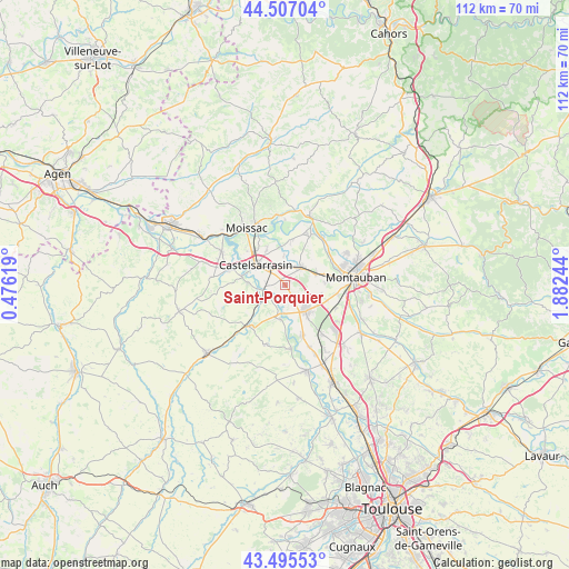
Saint-Porquier GPS coordinates[2]
44° 0' 12.384" North, 1° 10' 45.552" East
| Map corner | latitude | longitude |
|---|---|---|
| Upper-left | 44.50704°, | 0.47619° |
| Center: | 44.00344°, | 1.17932° |
| Lower-right: | 43.49553°, | 1.88244° |
| Map W x H: | 112.5×112.5 km | = 69.9×69.9mi |
| max Lat: | 51.07786° ⇑87.1% North |
| Saint-Porquier: | 44.00344° |
| min Lat: | ⇓12.9% South 41.3874° |
| min Long | Saint-Porquier | max Long |
| -5.08615° | 1.17932° | 9.52242° |
| W 33%⇐ | ⇒67% E |
Elevation
Elevation of Saint-Porquier is 93 m = 305 ft, and this is 100.7 m = 330 ft below average elevation for this country.
| Max E: |
2333 m = 7654 ft | 63.6% |
| Avg. | 193.7 m = 635 ft | |
| Saint-Porquier | 93 m = 305 ft | |
Min E: |
-1 m = -3 ft | 36.4% |
See also: France elevation on elevation.city.
Geographical zone
Saint-Porquier is located in North temperate zone (between Tropic of Cancer and the Arctic Circle). Distance of this Northern Tropic circle is 2286.8 km =1421 mi to South.| Distance of | km | miles | from Saint-Porquier |
|---|---|---|---|
| North Pole | 5114.3 | 3177.9 | to North |
| Arctic Circle | 2508.5 | 1558.7 | to North |
| Tropic Cancer | 2286.8 | 1421 | to South |
| Equator | 4892.7 | 3040.2 | to South |


Nearby cities:
15 places around Saint-Porquier: (largest is in red/bold)
• Albefeuille-Lagarde
8.3 km =5.2 mi,  53°
53°
• Bourret
6.8 km =4.2 mi,  187°
187°
• Castelmayran
11.6 km =7.2 mi,  284°
284°
• Castelsarrasin
7.1 km =4.4 mi,  305°
305°
• Escatalens
2.2 km =1.4 mi,  159°
159°
• Finhan
10.6 km =6.6 mi, 161°
• Garganvillar
9.3 km =5.8 mi,  252°
252°
• Labastide-du-Temple
9.1 km =5.7 mi,  8°
8°
• Lacourt-Saint-Pierre
7.1 km =4.4 mi,  106°
106°
• Larrazet
11.1 km =6.9 mi,  223°
223°
• Meauzac
10.6 km =6.6 mi,  27°
27°
• Montbeton
9.8 km =6.1 mi,  81°
81°
• Montech
6.6 km =4.1 mi,  140°
140°
• Saint-Sardos
12.1 km =7.5 mi,  197°
197°
• Villemade
11.8 km =7.3 mi, 47°
Sources, notices
• [Note1] Compared only with cities in France existing in our database
• [Src1] Map data: © OpenStreetMap contributors (CC-BY-SA)
• [Src2] Other city data from geonames.org with taken over terms of usage.
• [Src3] Geographical zone / Annual Mean Temperature by Robert A. Rohde @ Wikipedia
