Saint-Joachim geodata
Saint-Joachim (Pays de la Loire) is a populated place; located in France in Europe/Paris (GMT+2) time zone. With population of 4,087 people, there are 2404 cities with bigger population in this country. Compared to other cities in France, 50.3% of cities are located further ↑North; 95.5% of cities are located further →East and 99.3% of cities have higher elevation than Saint-Joachim. Note1
Administrative division(s):
- Level 1: Pays de la Loire
- Level 2: Loire-Atlantique
- Level 3: Arrondissement de Saint-Nazaire
- Level 4: Saint-Joachim


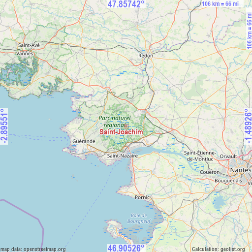
Saint-Joachim GPS coordinates[2]
47° 23' 0.564" North, 2° 11' 32.604" West
| Map corner | latitude | longitude |
|---|---|---|
| Upper-left | 47.85742°, | -2.89551° |
| Center: | 47.38349°, | -2.19239° |
| Lower-right: | 46.90526°, | -1.48926° |
| Map W x H: | 105.9×105.9 km | = 65.8×65.8mi |
| max Lat: | 51.07786° ⇑50.3% North |
| Saint-Joachim: | 47.38349° |
| min Lat: | ⇓49.7% South 41.3874° |
| min Long | Saint-Joachim | max Long |
| -5.08615° | -2.19239° | 9.52242° |
| W 4.5%⇐ | ⇒95.5% E |
Elevation
Elevation of Saint-Joachim is 5 m = 16 ft, and this is 188.7 m = 619 ft below average elevation for this country.
| Max E: |
2333 m = 7654 ft | 99.3% |
| Avg. | 193.7 m = 635 ft | |
| Saint-Joachim | 5 m = 16 ft | |
Min E: |
-1 m = -3 ft | 0.7% |
See also: France elevation on elevation.city.
Geographical zone
Saint-Joachim is located in North temperate zone (between Tropic of Cancer and the Arctic Circle). Distance of this North polar circle is 2132.6 km =1325.1 mi to North.| Distance of | km | miles | from Saint-Joachim |
|---|---|---|---|
| North Pole | 4738.5 | 2944.4 | to North |
| Arctic Circle | 2132.6 | 1325.1 | to North |
| Tropic Cancer | 2662.6 | 1654.5 | to South |
| Equator | 5268.6 | 3273.8 | to South |


Nearby cities:
15 places around Saint-Joachim: (largest is in red/bold)
• Besné
7.9 km =4.9 mi,  76°
76°
• Crossac
3.5 km =2.2 mi,  29°
29°
• Donges
11.4 km =7.1 mi,  129°
129°
• Herbignac
11.9 km =7.4 mi,  307°
307°
• La Chapelle-des-Marais
8 km =5 mi,  334°
334°
• Le Pin
4.2 km =2.6 mi,  152°
152°
• Missillac
11.2 km =7 mi,  12°
12°
• Montoir-de-Bretagne
6.7 km =4.2 mi, 152°
• Pontchâteau
9.8 km =6.1 mi,  51°
51°
• Saint-André-des-Eaux
11.8 km =7.3 mi,  229°
229°
• Saint-Lyphard
8.7 km =5.4 mi,  280°
280°
• Saint-Malo-de-Guersac
3.5 km =2.2 mi,  161°
161°
• Saint-Nazaire
11.6 km =7.2 mi,  186°
186°
• Sainte-Reine-de-Bretagne
6.4 km =4 mi,  0°
0°
• Trignac
7.3 km =4.5 mi,  177°
177°
Sources, notices
• [Note1] Compared only with cities in France existing in our database
• [Src1] Map data: © OpenStreetMap contributors (CC-BY-SA)
• [Src2] Other city data from geonames.org with taken over terms of usage.
• [Src3] Geographical zone / Annual Mean Temperature by Robert A. Rohde @ Wikipedia
