Saint-Julien-sur-Sarthe geodata
Saint-Julien-sur-Sarthe (Normandy) is a populated place; located in France in Europe/Paris (GMT+2) time zone. With population of 612 people, there are 13126 cities with bigger population in this country. Compared to other cities in France, 68.1% of cities are located further ↓South; 74.7% of cities are located further →East and 61.9% of cities have lower elevation than Saint-Julien-sur-Sarthe. Note1
Administrative division(s):
- Level 1: Normandy
- Level 2: Département de l'Orne
- Level 3: Arrondissement d’Alençon
- Level 4: Saint-Julien-sur-Sarthe
Current local time in Saint-Julien-sur-Sarthe:
02:01 PM, SaturdayDifference from your time zone: hours


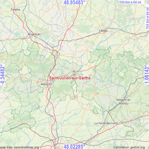
Saint-Julien-sur-Sarthe GPS coordinates[2]
48° 29' 27.528" North, 0° 21' 29.88" East
| Map corner | latitude | longitude |
|---|---|---|
| Upper-left | 48.95483°, | -0.34482° |
| Center: | 48.49098°, | 0.3583° |
| Lower-right: | 48.02285°, | 1.06143° |
| Map W x H: | 103.6×103.6 km | = 64.4×64.4mi |
| max Lat: | 51.07786° ⇑31.9% North |
| Saint-Julien-sur-Sarthe: | 48.49098° |
| min Lat: | ⇓68.1% South 41.3874° |
| min Long | Saint-Julien-su | max Long |
| -5.08615° | 0.3583° | 9.52242° |
| W 25.3%⇐ | ⇒74.7% E |
Elevation
Elevation of Saint-Julien-sur-Sarthe is 179 m = 587 ft, and this is 14.7 m = 48 ft below average elevation for this country.
| Max E: |
2333 m = 7654 ft | 38.1% |
| Avg. | 193.7 m = 635 ft | |
| Saint-Julien-sur-Sarthe | 179 m = 587 ft | |
Min E: |
-1 m = -3 ft | 61.9% |
See also: France elevation on elevation.city.
Geographical zone
Saint-Julien-sur-Sarthe is located in North temperate zone (between Tropic of Cancer and the Arctic Circle). Distance of this North polar circle is 2009.5 km =1248.6 mi to North.| Distance of | km | miles | from Saint-Julien-sur-Sarthe |
|---|---|---|---|
| North Pole | 4615.4 | 2867.9 | to North |
| Arctic Circle | 2009.5 | 1248.6 | to North |
| Tropic Cancer | 2785.8 | 1731 | to South |
| Equator | 5391.7 | 3350.2 | to South |


Nearby cities:
15 places around Saint-Julien-sur-Sarthe: (largest is in red/bold)
• Bazoches-sur-Hoëne
10.9 km =6.8 mi,  51°
51°
• Cerisé
17.2 km =10.7 mi,  254°
254°
• Courtomer
15.2 km =9.4 mi,  359°
359°
• Essay
9.9 km =6.2 mi,  304°
304°
• La Fresnaye-sur-Chédouet
9 km =5.6 mi,  238°
238°
• Le Chevain
18.1 km =11.2 mi, 248°
• Le Gué-de-la-Chaîne
17.7 km =11 mi,  137°
137°
• Le Mêle-sur-Sarthe
2.4 km =1.5 mi,  354°
354°
• Le Pin-la-Garenne
14.9 km =9.3 mi,  110°
110°
• Mamers
15.7 km =9.8 mi,  177°
177°
• Mortagne-au-Perche
14.3 km =8.9 mi,  76°
76°
• Neufchâtel-en-Saosnois
15.1 km =9.4 mi,  212°
212°
• Saint-Hilaire-le-Châtel
14.8 km =9.2 mi,  57°
57°
• Saint-Langis-lès-Mortagne
14.4 km =8.9 mi, 79°
• Sainte-Scolasse-sur-Sarthe
9.9 km =6.2 mi,  15°
15°
Sources, notices
• [Note1] Compared only with cities in France existing in our database
• [Src1] Map data: © OpenStreetMap contributors (CC-BY-SA)
• [Src2] Other city data from geonames.org with taken over terms of usage.
• [Src3] Geographical zone / Annual Mean Temperature by Robert A. Rohde @ Wikipedia
