Mortagne-au-Perche geodata
Mortagne-au-Perche (Normandy) is a seat of a third-order administrative division; located in France in Europe/Paris (GMT+2) time zone. With population of 4,893 people, there are 2024 cities with bigger population in this country. Compared to other cities in France, 68.8% of cities are located further ↓South; 73% of cities are located further →East and 70.6% of cities have lower elevation than Mortagne-au-Perche. Note1
Administrative division(s):
- Level 1: Normandy
- Level 2: Département de l'Orne
- Level 3: Arrondissement de Mortagne-au-Perche
- Level 4: Mortagne-au-Perche


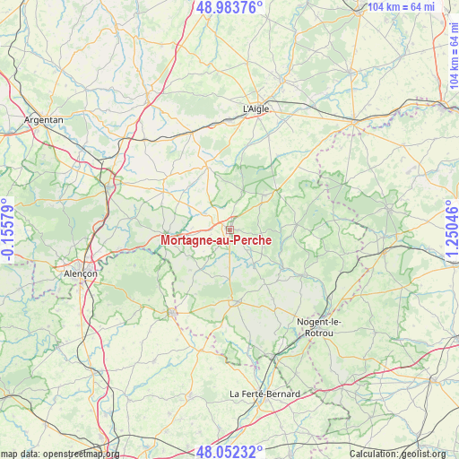
Mortagne-au-Perche GPS coordinates[2]
48° 31' 12.648" North, 0° 32' 50.424" East
| Map corner | latitude | longitude |
|---|---|---|
| Upper-left | 48.98376°, | -0.15579° |
| Center: | 48.52018°, | 0.54734° |
| Lower-right: | 48.05232°, | 1.25046° |
| Map W x H: | 103.6×103.6 km | = 64.4×64.4mi |
| max Lat: | 51.07786° ⇑31.2% North |
| Mortagne-au-Perche: | 48.52018° |
| min Lat: | ⇓68.8% South 41.3874° |
| min Long | Mortagne-au-Per | max Long |
| -5.08615° | 0.54734° | 9.52242° |
| W 27%⇐ | ⇒73% E |
Elevation
Elevation of Mortagne-au-Perche is 222 m = 728 ft, and this is 28.3 m = 93 ft above average elevation for this country.
| Max E: |
2333 m = 7654 ft | 29.4% |
| Mortagne-au-Perche | 222 m 728 ft | |
| Avg. | 193.7 m = 635 ft | |
Min E: |
-1 m = -3 ft | 70.6% |
See also: France elevation on elevation.city.
Geographical zone
Mortagne-au-Perche is located in North temperate zone (between Tropic of Cancer and the Arctic Circle). Distance of this North polar circle is 2006.2 km =1246.6 mi to North.| Distance of | km | miles | from Mortagne-au-Perche |
|---|---|---|---|
| North Pole | 4612.1 | 2865.8 | to North |
| Arctic Circle | 2006.2 | 1246.6 | to North |
| Tropic Cancer | 2789 | 1733 | to South |
| Equator | 5394.9 | 3352.2 | to South |


Nearby cities:
15 places around Mortagne-au-Perche: (largest is in red/bold)
• Bazoches-sur-Hoëne
6.4 km =4 mi,  303°
303°
• Bellême
16.4 km =10.2 mi,  174°
174°
• La Chapelle-Montligeon
9.1 km =5.7 mi,  117°
117°
• Le Mêle-sur-Sarthe
14.2 km =8.8 mi,  266°
266°
• Le Pin-la-Garenne
8.6 km =5.3 mi,  180°
180°
• Longny-au-Perche
15.1 km =9.4 mi,  85°
85°
• Mauves-sur-Huisne
9.4 km =5.8 mi,  145°
145°
• Moulins-la-Marche
15.5 km =9.6 mi,  340°
340°
• Saint-Hilaire-le-Châtel
4.9 km =3 mi, 343°
• Saint-Julien-sur-Sarthe
14.3 km =8.9 mi,  256°
256°
• Saint-Langis-lès-Mortagne
0.6 km =0.4 mi,  162°
162°
• Saint-Martin-du-Vieux-Bellême
15.5 km =9.6 mi, 181°
• Sainte-Scolasse-sur-Sarthe
13 km =8.1 mi, 298°
• Soligny-la-Trappe
10.5 km =6.5 mi,  355°
355°
• Tourouvre
10.9 km =6.8 mi,  45°
45°
Sources, notices
• [Note1] Compared only with cities in France existing in our database
• [Src1] Map data: © OpenStreetMap contributors (CC-BY-SA)
• [Src2] Other city data from geonames.org with taken over terms of usage.
• [Src3] Geographical zone / Annual Mean Temperature by Robert A. Rohde @ Wikipedia
