Le Mêle-sur-Sarthe geodata
Le Mêle-sur-Sarthe (Normandy) is a populated place; located in France in Europe/Paris (GMT+2) time zone. With population of 798 people, there are 10635 cities with bigger population in this country. Compared to other cities in France, 68.6% of cities are located further ↓South; 74.8% of cities are located further →East and 57.4% of cities have lower elevation than Le Mêle-sur-Sarthe. Note1
Administrative division(s):
- Level 1: Normandy
- Level 2: Département de l'Orne
- Level 3: Arrondissement d’Alençon
- Level 4: Le Mêle-sur-Sarthe


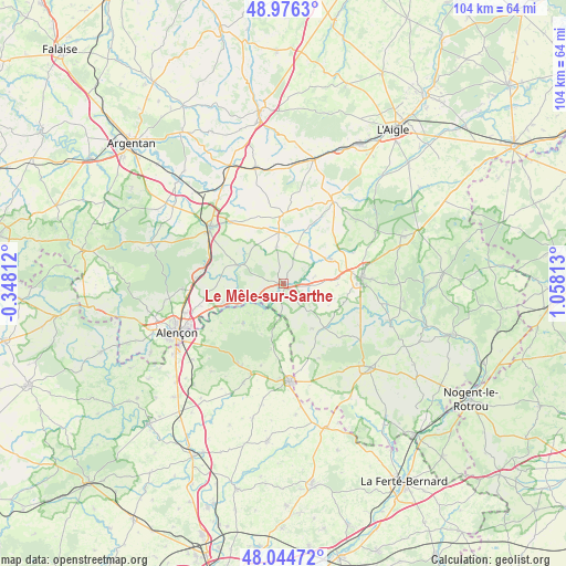
Le Mêle-sur-Sarthe GPS coordinates[2]
48° 30' 45.54" North, 0° 21' 18.036" East
| Map corner | latitude | longitude |
|---|---|---|
| Upper-left | 48.9763°, | -0.34812° |
| Center: | 48.51265°, | 0.35501° |
| Lower-right: | 48.04472°, | 1.05813° |
| Map W x H: | 103.6×103.6 km | = 64.4×64.4mi |
| max Lat: | 51.07786° ⇑31.4% North |
| Le Mêle-sur-Sarthe: | 48.51265° |
| min Lat: | ⇓68.6% South 41.3874° |
| min Long | Le Mêle-sur-Sa | max Long |
| -5.08615° | 0.35501° | 9.52242° |
| W 25.2%⇐ | ⇒74.8% E |
Elevation
Elevation of Le Mêle-sur-Sarthe is 159 m = 522 ft, and this is 34.7 m = 114 ft below average elevation for this country.
| Max E: |
2333 m = 7654 ft | 42.6% |
| Avg. | 193.7 m = 635 ft | |
| Le Mêle-sur-Sarthe | 159 m = 522 ft | |
Min E: |
-1 m = -3 ft | 57.4% |
See also: France elevation on elevation.city.
Geographical zone
Le Mêle-sur-Sarthe is located in North temperate zone (between Tropic of Cancer and the Arctic Circle). Distance of this North polar circle is 2007.1 km =1247.2 mi to North.| Distance of | km | miles | from Le Mêle-sur-Sarthe |
|---|---|---|---|
| North Pole | 4613 | 2866.4 | to North |
| Arctic Circle | 2007.1 | 1247.2 | to North |
| Tropic Cancer | 2788.2 | 1732.5 | to South |
| Equator | 5394.1 | 3351.7 | to South |


Nearby cities:
15 places around Le Mêle-sur-Sarthe: (largest is in red/bold)
• Bazoches-sur-Hoëne
9.8 km =6.1 mi,  63°
63°
• Cerisé
17.8 km =11.1 mi,  246°
246°
• Courtomer
12.8 km =8 mi,  0°
0°
• Essay
8.6 km =5.3 mi,  291°
291°
• La Fresnaye-sur-Chédouet
10.3 km =6.4 mi,  225°
225°
• Le Pin-la-Garenne
16.1 km =10 mi,  118°
118°
• Mortagne-au-Perche
14.2 km =8.8 mi,  86°
86°
• Moulins-la-Marche
17.8 km =11.1 mi,  29°
29°
• Neufchâtel-en-Saosnois
17.1 km =10.6 mi,  207°
207°
• Saint-Hilaire-le-Châtel
13.9 km =8.6 mi,  66°
66°
• Saint-Julien-sur-Sarthe
2.4 km =1.5 mi,  174°
174°
• Saint-Langis-lès-Mortagne
14.3 km =8.9 mi, 88°
• Sainte-Scolasse-sur-Sarthe
7.6 km =4.7 mi,  21°
21°
• Soligny-la-Trappe
17.5 km =10.9 mi,  49°
49°
• Sées
16.8 km =10.4 mi,  307°
307°
Sources, notices
• [Note1] Compared only with cities in France existing in our database
• [Src1] Map data: © OpenStreetMap contributors (CC-BY-SA)
• [Src2] Other city data from geonames.org with taken over terms of usage.
• [Src3] Geographical zone / Annual Mean Temperature by Robert A. Rohde @ Wikipedia
