Saint-Julien-sur-Cher geodata
Saint-Julien-sur-Cher (Centre) is a populated place; located in France in Europe/Paris (GMT+2) time zone. With population of 690 people, there are 11939 cities with bigger population in this country. Compared to other cities in France, 51.8% of cities are located further ↑North; 59.6% of cities are located further →East and 64% of cities have higher elevation than Saint-Julien-sur-Cher. Note1
Administrative division(s):
- Level 1: Centre
- Level 2: Département du Loir-et-Cher
- Level 3: Arrondissement de Romorantin-Lanthenay
- Level 4: Saint-Julien-sur-Cher
Current local time in Saint-Julien-sur-Cher:
03:45 AM, SaturdayDifference from your time zone: hours


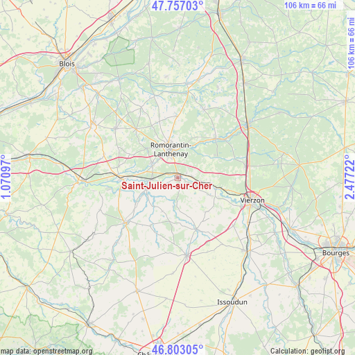
Saint-Julien-sur-Cher GPS coordinates[2]
47° 16' 55.884" North, 1° 46' 26.724" East
| Map corner | latitude | longitude |
|---|---|---|
| Upper-left | 47.75703°, | 1.07097° |
| Center: | 47.28219°, | 1.77409° |
| Lower-right: | 46.80305°, | 2.47722° |
| Map W x H: | 106.1×106.1 km | = 65.9×65.9mi |
| max Lat: | 51.07786° ⇑51.8% North |
| Saint-Julien-sur-Cher: | 47.28219° |
| min Lat: | ⇓48.2% South 41.3874° |
| min Long | Saint-Julien-su | max Long |
| -5.08615° | 1.77409° | 9.52242° |
| W 40.4%⇐ | ⇒59.6% E |
Elevation
Elevation of Saint-Julien-sur-Cher is 92 m = 302 ft, and this is 101.7 m = 334 ft below average elevation for this country.
| Max E: |
2333 m = 7654 ft | 64% |
| Avg. | 193.7 m = 635 ft | |
| Saint-Julien-sur-Cher | 92 m = 302 ft | |
Min E: |
-1 m = -3 ft | 36% |
See also: France elevation on elevation.city.
Geographical zone
Saint-Julien-sur-Cher is located in North temperate zone (between Tropic of Cancer and the Arctic Circle). Distance of this North polar circle is 2143.9 km =1332.2 mi to North.| Distance of | km | miles | from Saint-Julien-sur-Cher |
|---|---|---|---|
| North Pole | 4749.8 | 2951.4 | to North |
| Arctic Circle | 2143.9 | 1332.2 | to North |
| Tropic Cancer | 2651.4 | 1647.5 | to South |
| Equator | 5257.3 | 3266.7 | to South |


Nearby cities:
15 places around Saint-Julien-sur-Cher: (largest is in red/bold)
• Chabris
9.8 km =6.1 mi,  250°
250°
• Châtres-sur-Cher
10.1 km =6.3 mi,  100°
100°
• Genouilly
13.2 km =8.2 mi,  140°
140°
• Gièvres
7.9 km =4.9 mi,  267°
267°
• Gy-en-Sologne
16 km =9.9 mi,  295°
295°
• Langon
3.9 km =2.4 mi,  86°
86°
• Mennetou-sur-Cher
7 km =4.3 mi, 101°
• Pruniers-en-Sologne
9 km =5.6 mi, 295°
• Romorantin-Lanthenay
9.6 km =6 mi,  349°
349°
• Saint-Georges-sur-la-Prée
13.7 km =8.5 mi,  116°
116°
• Selles-Saint-Denis
16.2 km =10.1 mi,  43°
43°
• Thénioux
12.5 km =7.8 mi, 103°
• Varennes-sur-Fouzon
14.9 km =9.3 mi,  238°
238°
• Villefranche-sur-Cher
2.1 km =1.3 mi,  344°
344°
• Villeherviers
9.6 km =6 mi,  11°
11°
Sources, notices
• [Note1] Compared only with cities in France existing in our database
• [Src1] Map data: © OpenStreetMap contributors (CC-BY-SA)
• [Src2] Other city data from geonames.org with taken over terms of usage.
• [Src3] Geographical zone / Annual Mean Temperature by Robert A. Rohde @ Wikipedia
