Saint-Hilaire geodata
Saint-Hilaire (Auvergne-Rhône-Alpes) is a populated place; located in France in Europe/Paris (GMT+2) time zone. With population of 512 people, there are 14990 cities with bigger population in this country. Compared to other cities in France, 60.2% of cities are located further ↑North; 58.1% of cities are located further ←West and 83.9% of cities have lower elevation than Saint-Hilaire. Note1
Administrative division(s):
- Level 1: Auvergne-Rhône-Alpes
- Level 2: Département de l'Allier
- Level 3: Arrondissement de Moulins
- Level 4: Saint-Hilaire


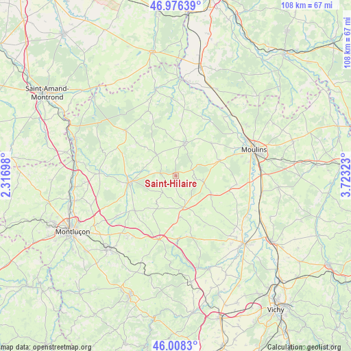
Saint-Hilaire GPS coordinates[2]
46° 29' 40.2" North, 3° 1' 12.36" East
| Map corner | latitude | longitude |
|---|---|---|
| Upper-left | 46.97639°, | 2.31698° |
| Center: | 46.4945°, | 3.0201° |
| Lower-right: | 46.0083°, | 3.72323° |
| Map W x H: | 107.6×107.6 km | = 66.9×66.9mi |
| max Lat: | 51.07786° ⇑60.2% North |
| Saint-Hilaire: | 46.4945° |
| min Lat: | ⇓39.8% South 41.3874° |
| min Long | Saint-Hilaire | max Long |
| -5.08615° | 3.0201° | 9.52242° |
| W 58.1%⇐ | ⇒41.9% E |
Elevation
Elevation of Saint-Hilaire is 333 m = 1093 ft, and this is 139.3 m = 457 ft above average elevation for this country.
| Max E: |
2333 m = 7654 ft | 16.1% |
| Saint-Hilaire | 333 m 1093 ft | |
| Avg. | 193.7 m = 635 ft | |
Min E: |
-1 m = -3 ft | 83.9% |
See also: France elevation on elevation.city.
Geographical zone
Saint-Hilaire is located in North temperate zone (between Tropic of Cancer and the Arctic Circle). Distance of this North polar circle is 2231.5 km =1386.6 mi to North.| Distance of | km | miles | from Saint-Hilaire |
|---|---|---|---|
| North Pole | 4837.4 | 3005.8 | to North |
| Arctic Circle | 2231.5 | 1386.6 | to North |
| Tropic Cancer | 2563.8 | 1593.1 | to South |
| Equator | 5169.7 | 3212.3 | to South |


Nearby cities:
15 places around Saint-Hilaire: (largest is in red/bold)
• Besson
18.9 km =11.7 mi,  98°
98°
• Bourbon-l’Archambault
10.3 km =6.4 mi,  15°
15°
• Buxières-les-Mines
5.5 km =3.4 mi,  237°
237°
• Coulandon
19.1 km =11.9 mi,  70°
70°
• Couleuvre
21.6 km =13.4 mi,  336°
336°
• Cressanges
12 km =7.5 mi,  116°
116°
• Cérilly
20.5 km =12.7 mi,  312°
312°
• Le Montet
9.9 km =6.2 mi,  164°
164°
• Montmarault
20.3 km =12.6 mi,  194°
194°
• Noyant-d’Allier
8.1 km =5 mi, 101°
• Saint-Menoux
14.7 km =9.1 mi,  47°
47°
• Souvigny
13.9 km =8.6 mi, 71°
• Tronget
8.8 km =5.5 mi, 155°
• Villefranche-d’Allier
16.6 km =10.3 mi,  228°
228°
• Ygrande
8.7 km =5.4 mi,  317°
317°
Sources, notices
• [Note1] Compared only with cities in France existing in our database
• [Src1] Map data: © OpenStreetMap contributors (CC-BY-SA)
• [Src2] Other city data from geonames.org with taken over terms of usage.
• [Src3] Geographical zone / Annual Mean Temperature by Robert A. Rohde @ Wikipedia
