Montmarault geodata
Montmarault (Auvergne-Rhône-Alpes) is a populated place; located in France in Europe/Paris (GMT+2) time zone. With population of 1,701 people, there are 5519 cities with bigger population in this country. Compared to other cities in France, 62.1% of cities are located further ↑North; 57.2% of cities are located further ←West and 92% of cities have lower elevation than Montmarault. Note1
Administrative division(s):
- Level 1: Auvergne-Rhône-Alpes
- Level 2: Département de l'Allier
- Level 3: Arrondissement de Montluçon
- Level 4: Montmarault


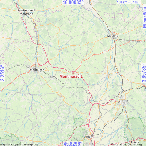
Montmarault GPS coordinates[2]
46° 19' 2.568" North, 2° 57' 16.992" East
| Map corner | latitude | longitude |
|---|---|---|
| Upper-left | 46.80085°, | 2.2516° |
| Center: | 46.31738°, | 2.95472° |
| Lower-right: | 45.8296°, | 3.65785° |
| Map W x H: | 108×108 km | = 67.1×67.1mi |
| max Lat: | 51.07786° ⇑62.1% North |
| Montmarault: | 46.31738° |
| min Lat: | ⇓37.9% South 41.3874° |
| min Long | Montmarault | max Long |
| -5.08615° | 2.95472° | 9.52242° |
| W 57.2%⇐ | ⇒42.8% E |
Elevation
Elevation of Montmarault is 477 m = 1565 ft, and this is 283.3 m = 929 ft above average elevation for this country.
| Max E: |
2333 m = 7654 ft | 8% |
| Montmarault | 477 m 1565 ft | |
| Avg. | 193.7 m = 635 ft | |
Min E: |
-1 m = -3 ft | 92% |
See also: France elevation on elevation.city.
Geographical zone
Montmarault is located in North temperate zone (between Tropic of Cancer and the Arctic Circle). Distance of this North polar circle is 2251.2 km =1398.8 mi to North.| Distance of | km | miles | from Montmarault |
|---|---|---|---|
| North Pole | 4857.1 | 3018.1 | to North |
| Arctic Circle | 2251.2 | 1398.8 | to North |
| Tropic Cancer | 2544.1 | 1580.8 | to South |
| Equator | 5150 | 3200.1 | to South |


Nearby cities:
15 places around Montmarault: (largest is in red/bold)
• Bellenaves
16.2 km =10.1 mi,  143°
143°
• Buxières-les-Mines
16.8 km =10.4 mi,  1°
1°
• Bézenet
8.5 km =5.3 mi,  278°
278°
• Chamblet
19.5 km =12.1 mi, 275°
• Chantelle
17.6 km =10.9 mi,  120°
120°
• Commentry
16.7 km =10.4 mi,  258°
258°
• Doyet
12.3 km =7.6 mi, 279°
• Lapeyrouse
12.2 km =7.6 mi,  211°
211°
• Le Montet
12.8 km =8 mi,  37°
37°
• Malicorne
13.4 km =8.3 mi, 262°
• Montaigut
19 km =11.8 mi,  216°
216°
• Montvicq
10.2 km =6.3 mi,  271°
271°
• Saint-Éloy-les-Mines
19.8 km =12.3 mi, 208°
• Tronget
14.6 km =9.1 mi, 36°
• Villefranche-d’Allier
11.6 km =7.2 mi,  319°
319°
Sources, notices
• [Note1] Compared only with cities in France existing in our database
• [Src1] Map data: © OpenStreetMap contributors (CC-BY-SA)
• [Src2] Other city data from geonames.org with taken over terms of usage.
• [Src3] Geographical zone / Annual Mean Temperature by Robert A. Rohde @ Wikipedia
