Saint-Georges-de-Noisné geodata
Saint-Georges-de-Noisné (Nouvelle-Aquitaine) is a populated place; located in France in Europe/Paris (GMT+2) time zone. With population of 686 people, there are 12000 cities with bigger population in this country. Compared to other cities in France, 60.2% of cities are located further ↑North; 80.4% of cities are located further →East and 64.6% of cities have lower elevation than Saint-Georges-de-Noisné. Note1
Administrative division(s):
- Level 1: Nouvelle-Aquitaine
- Level 2: Département des Deux-Sèvres
- Level 3: Arrondissement de Parthenay
- Level 4: Saint-Georges-de-Noisné
Current local time in Saint-Georges-de-Noisné:
01:43 PM, WednesdayDifference from your time zone: hours


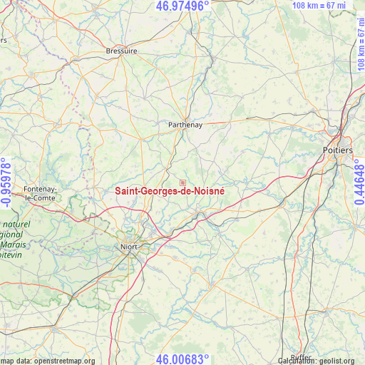
Saint-Georges-de-Noisné GPS coordinates[2]
46° 29' 34.98" North, 0° 15' 23.94" West
| Map corner | latitude | longitude |
|---|---|---|
| Upper-left | 46.97496°, | -0.95978° |
| Center: | 46.49305°, | -0.25665° |
| Lower-right: | 46.00683°, | 0.44648° |
| Map W x H: | 107.6×107.6 km | = 66.9×66.9mi |
| max Lat: | 51.07786° ⇑60.2% North |
| Saint-Georges-de-Noisné: | 46.49305° |
| min Lat: | ⇓39.8% South 41.3874° |
| min Long | Saint-Georges-d | max Long |
| -5.08615° | -0.25665° | 9.52242° |
| W 19.6%⇐ | ⇒80.4% E |
Elevation
Elevation of Saint-Georges-de-Noisné is 192 m = 630 ft, and this is 1.7 m = 6 ft below average elevation for this country.
| Max E: |
2333 m = 7654 ft | 35.4% |
| Avg. | 193.7 m = 635 ft | |
| Saint-Georges-de-Noisné | 192 m = 630 ft | |
Min E: |
-1 m = -3 ft | 64.6% |
See also: France elevation on elevation.city.
Geographical zone
Saint-Georges-de-Noisné is located in North temperate zone (between Tropic of Cancer and the Arctic Circle). Distance of this North polar circle is 2231.6 km =1386.7 mi to North.| Distance of | km | miles | from Saint-Georges-de-Noisné |
|---|---|---|---|
| North Pole | 4837.5 | 3005.9 | to North |
| Arctic Circle | 2231.6 | 1386.7 | to North |
| Tropic Cancer | 2563.6 | 1592.9 | to South |
| Equator | 5169.5 | 3212.2 | to South |


Nearby cities:
15 places around Saint-Georges-de-Noisné: (largest is in red/bold)
• Augé
6.4 km =4 mi,  201°
201°
• Azay-le-Brûlé
10.2 km =6.3 mi,  175°
175°
• Beaulieu-sous-Parthenay
9.4 km =5.8 mi,  10°
10°
• Champdeniers-Saint-Denis
11 km =6.8 mi,  264°
264°
• Cherveux
11.6 km =7.2 mi,  221°
221°
• Exireuil
8.3 km =5.2 mi,  143°
143°
• Germond-Rouvre
13.2 km =8.2 mi,  248°
248°
• Mazières-en-Gâtine
6.7 km =4.2 mi,  311°
311°
• Nanteuil
11 km =6.8 mi, 144°
• Pompaire
12.9 km =8 mi, 7°
• Saint-Martin-de-Saint-Maixent
11.9 km =7.4 mi,  155°
155°
• Saint-Pardoux
9.5 km =5.9 mi,  336°
336°
• Sainte-Néomaye
13.4 km =8.3 mi, 180°
• Saivres
6.9 km =4.3 mi,  167°
167°
• Verruyes
3.6 km =2.2 mi,  316°
316°
Sources, notices
• [Note1] Compared only with cities in France existing in our database
• [Src1] Map data: © OpenStreetMap contributors (CC-BY-SA)
• [Src2] Other city data from geonames.org with taken over terms of usage.
• [Src3] Geographical zone / Annual Mean Temperature by Robert A. Rohde @ Wikipedia
