Villefranche-de-Panat geodata
Villefranche-de-Panat (Occitanie) is a populated place; located in France in Europe/Paris (GMT+2) time zone. With population of 796 people, there are 10658 cities with bigger population in this country. Compared to other cities in France, 86.3% of cities are located further ↑North; 53.6% of cities are located further ←West and 97% of cities have lower elevation than Villefranche-de-Panat. Note1
Administrative division(s):
- Level 1: Occitanie
- Level 2: Département de l'Aveyron
- Level 3: Arrondissement de Millau
- Level 4: Villefranche-de-Panat
Current local time in Villefranche-de-Panat:
03:55 PM, SaturdayDifference from your time zone: hours


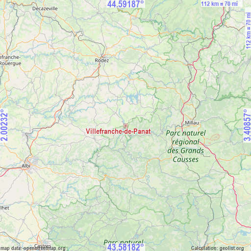
Villefranche-de-Panat GPS coordinates[2]
44° 5' 20.4" North, 2° 42' 19.62" East
| Map corner | latitude | longitude |
|---|---|---|
| Upper-left | 44.59187°, | 2.00232° |
| Center: | 44.089°, | 2.70545° |
| Lower-right: | 43.58182°, | 3.40857° |
| Map W x H: | 112.3×112.3 km | = 69.8×69.8mi |
| max Lat: | 51.07786° ⇑86.3% North |
| Villefranche-de-Panat: | 44.089° |
| min Lat: | ⇓13.7% South 41.3874° |
| min Long | Villefranche-de | max Long |
| -5.08615° | 2.70545° | 9.52242° |
| W 53.6%⇐ | ⇒46.4% E |
Elevation
Elevation of Villefranche-de-Panat is 728 m = 2388 ft, and this is 534.3 m = 1753 ft above average elevation for this country.
| Max E: |
2333 m = 7654 ft | 3% |
| Villefranche-de-Panat | 728 m 2388 ft | |
| Avg. | 193.7 m = 635 ft | |
Min E: |
-1 m = -3 ft | 97% |
See also: France elevation on elevation.city.
Geographical zone
Villefranche-de-Panat is located in North temperate zone (between Tropic of Cancer and the Arctic Circle). Distance of this Northern Tropic circle is 2296.3 km =1426.9 mi to South.| Distance of | km | miles | from Villefranche-de-Panat |
|---|---|---|---|
| North Pole | 5104.8 | 3172 | to North |
| Arctic Circle | 2498.9 | 1552.7 | to North |
| Tropic Cancer | 2296.3 | 1426.9 | to South |
| Equator | 4902.2 | 3046.1 | to South |


Nearby cities:
15 places around Villefranche-de-Panat: (largest is in red/bold)
• Arvieu
12 km =7.5 mi,  342°
342°
• Broquiès
9.4 km =5.8 mi,  184°
184°
• Cassagnes-Bégonhès
16.5 km =10.3 mi,  302°
302°
• Coupiac
18 km =11.2 mi,  213°
213°
• Durenque
7.3 km =4.5 mi,  288°
288°
• La Selve
13.6 km =8.5 mi,  281°
281°
• Lédergues
21.1 km =13.1 mi,  269°
269°
• Pont-de-Salars
21.4 km =13.3 mi,  4°
4°
• Réquista
14.9 km =9.3 mi,  245°
245°
• Saint-Affrique
20.9 km =13 mi,  135°
135°
• Saint-Rome-de-Tarn
15.9 km =9.9 mi,  106°
106°
• Salles-Curan
12.3 km =7.6 mi,  32°
32°
• Salmiech
14.7 km =9.1 mi,  314°
314°
• Trémouilles
18 km =11.2 mi, 344°
• Viala-du-Tarn
13.9 km =8.6 mi,  97°
97°
Sources, notices
• [Note1] Compared only with cities in France existing in our database
• [Src1] Map data: © OpenStreetMap contributors (CC-BY-SA)
• [Src2] Other city data from geonames.org with taken over terms of usage.
• [Src3] Geographical zone / Annual Mean Temperature by Robert A. Rohde @ Wikipedia
