Rivière-sur-Tarn geodata
Rivière-sur-Tarn (Occitanie) is a populated place; located in France in Europe/Paris (GMT+2) time zone. With population of 992 people, there are 8887 cities with bigger population in this country. Compared to other cities in France, 85.6% of cities are located further ↑North; 59.7% of cities are located further ←West and 87.8% of cities have lower elevation than Rivière-sur-Tarn. Note1
Administrative division(s):
- Level 1: Occitanie
- Level 2: Département de l'Aveyron
- Level 3: Arrondissement de Millau
- Level 4: Rivière-sur-Tarn


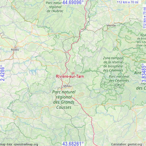
Rivière-sur-Tarn GPS coordinates[2]
44° 11' 20.184" North, 3° 7' 54.192" East
| Map corner | latitude | longitude |
|---|---|---|
| Upper-left | 44.69096°, | 2.4286° |
| Center: | 44.18894°, | 3.13172° |
| Lower-right: | 43.68261°, | 3.83485° |
| Map W x H: | 112.1×112.1 km | = 69.7×69.7mi |
| max Lat: | 51.07786° ⇑85.6% North |
| Rivière-sur-Tarn: | 44.18894° |
| min Lat: | ⇓14.4% South 41.3874° |
| min Long | Rivière-sur-Ta | max Long |
| -5.08615° | 3.13172° | 9.52242° |
| W 59.7%⇐ | ⇒40.3% E |
Elevation
Elevation of Rivière-sur-Tarn is 385 m = 1263 ft, and this is 191.3 m = 628 ft above average elevation for this country.
| Max E: |
2333 m = 7654 ft | 12.2% |
| Rivière-sur-Tarn | 385 m 1263 ft | |
| Avg. | 193.7 m = 635 ft | |
Min E: |
-1 m = -3 ft | 87.8% |
See also: France elevation on elevation.city.
Geographical zone
Rivière-sur-Tarn is located in North temperate zone (between Tropic of Cancer and the Arctic Circle). Distance of this Northern Tropic circle is 2307.4 km =1433.8 mi to South.| Distance of | km | miles | from Rivière-sur-Tarn |
|---|---|---|---|
| North Pole | 5093.7 | 3165.1 | to North |
| Arctic Circle | 2487.8 | 1545.8 | to North |
| Tropic Cancer | 2307.4 | 1433.8 | to South |
| Equator | 4913.3 | 3053 | to South |


Nearby cities:
15 places around Rivière-sur-Tarn: (largest is in red/bold)
• Aguessac
4.5 km =2.8 mi,  216°
216°
• Compeyre
3.9 km =2.4 mi, 217°
• Creissels
12.8 km =8 mi,  206°
206°
• La Cavalerie
20.1 km =12.5 mi,  173°
173°
• Lapanouse
18.3 km =11.4 mi,  334°
334°
• Meyrueis
23.9 km =14.9 mi,  93°
93°
• Millau
11 km =6.8 mi,  203°
203°
• Nant
23.1 km =14.4 mi,  143°
143°
• Saint-Beauzély
14.1 km =8.8 mi,  259°
259°
• Saint-Georges-de-Luzençon
18.1 km =11.2 mi, 220°
• Saint-Rome-de-Cernon
23.7 km =14.7 mi, 214°
• Saint-Rome-de-Tarn
24.4 km =15.2 mi,  230°
230°
• Sévérac-le-Château
16.1 km =10 mi,  339°
339°
• Viala-du-Tarn
24 km =14.9 mi,  237°
237°
• Vézins-de-Lévézou
17.4 km =10.8 mi,  305°
305°
Sources, notices
• [Note1] Compared only with cities in France existing in our database
• [Src1] Map data: © OpenStreetMap contributors (CC-BY-SA)
• [Src2] Other city data from geonames.org with taken over terms of usage.
• [Src3] Geographical zone / Annual Mean Temperature by Robert A. Rohde @ Wikipedia
