Salles-Curan geodata
Salles-Curan (Occitanie) is a populated place; located in France in Europe/Paris (GMT+2) time zone. With population of 1,157 people, there are 7785 cities with bigger population in this country. Compared to other cities in France, 85.6% of cities are located further ↑North; 54.7% of cities are located further ←West and 98.3% of cities have lower elevation than Salles-Curan. Note1
Administrative division(s):
- Level 1: Occitanie
- Level 2: Département de l'Aveyron
- Level 3: Arrondissement de Millau
- Level 4: Salles-Curan


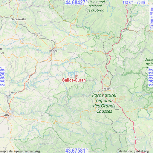
Salles-Curan GPS coordinates[2]
44° 10' 55.92" North, 2° 47' 17.556" East
| Map corner | latitude | longitude |
|---|---|---|
| Upper-left | 44.68427°, | 2.08508° |
| Center: | 44.1822°, | 2.78821° |
| Lower-right: | 43.67581°, | 3.49133° |
| Map W x H: | 112.1×112.1 km | = 69.7×69.7mi |
| max Lat: | 51.07786° ⇑85.6% North |
| Salles-Curan: | 44.1822° |
| min Lat: | ⇓14.4% South 41.3874° |
| min Long | Salles-Curan | max Long |
| -5.08615° | 2.78821° | 9.52242° |
| W 54.7%⇐ | ⇒45.3% E |
Elevation
Elevation of Salles-Curan is 856 m = 2808 ft, and this is 662.3 m = 2173 ft above average elevation for this country.
| Max E: |
2333 m = 7654 ft | 1.7% |
| Salles-Curan | 856 m 2808 ft | |
| Avg. | 193.7 m = 635 ft | |
Min E: |
-1 m = -3 ft | 98.3% |
See also: France elevation on elevation.city.
Geographical zone
Salles-Curan is located in North temperate zone (between Tropic of Cancer and the Arctic Circle). Distance of this Northern Tropic circle is 2306.7 km =1433.3 mi to South.| Distance of | km | miles | from Salles-Curan |
|---|---|---|---|
| North Pole | 5094.5 | 3165.6 | to North |
| Arctic Circle | 2488.6 | 1546.3 | to North |
| Tropic Cancer | 2306.7 | 1433.3 | to South |
| Equator | 4912.6 | 3052.5 | to South |


Nearby cities:
15 places around Salles-Curan: (largest is in red/bold)
• Arvieu
10.2 km =6.3 mi,  276°
276°
• Broquiès
21.1 km =13.1 mi,  200°
200°
• Cassagnes-Bégonhès
20.6 km =12.8 mi,  265°
265°
• Durenque
15.8 km =9.8 mi,  239°
239°
• Flavin
18.8 km =11.7 mi,  309°
309°
• Pont-de-Salars
12 km =7.5 mi,  336°
336°
• Saint-Beauzély
13.7 km =8.5 mi,  97°
97°
• Saint-Georges-de-Luzençon
20.5 km =12.7 mi,  129°
129°
• Saint-Rome-de-Tarn
17.2 km =10.7 mi,  149°
149°
• Salmiech
17.1 km =10.6 mi, 269°
• Ségur
12.8 km =8 mi,  16°
16°
• Trémouilles
13.4 km =8.3 mi,  301°
301°
• Viala-du-Tarn
14.2 km =8.8 mi, 149°
• Villefranche-de-Panat
12.3 km =7.6 mi,  212°
212°
• Vézins-de-Lévézou
17 km =10.6 mi,  50°
50°
Sources, notices
• [Note1] Compared only with cities in France existing in our database
• [Src1] Map data: © OpenStreetMap contributors (CC-BY-SA)
• [Src2] Other city data from geonames.org with taken over terms of usage.
• [Src3] Geographical zone / Annual Mean Temperature by Robert A. Rohde @ Wikipedia
