Saint-Étienne-de-Tinée geodata
Saint-Étienne-de-Tinée (Provence-Alpes-Côte d'Azur) is a populated place; located in France in Europe/Paris (GMT+2) time zone. With population of 1,311 people, there are 6972 cities with bigger population in this country. Compared to other cities in France, 85.1% of cities are located further ↑North; 94.4% of cities are located further ←West and 99.5% of cities have lower elevation than Saint-Étienne-de-Tinée. Note1
Administrative division(s):
- Level 1: Provence-Alpes-Côte d'Azur
- Level 2: Alpes-Maritimes
- Level 3: Arrondissement de Nice
- Level 4: Saint-Étienne-de-Tinée
Current local time in Saint-Étienne-de-Tinée:
05:52 AM, WednesdayDifference from your time zone: hours


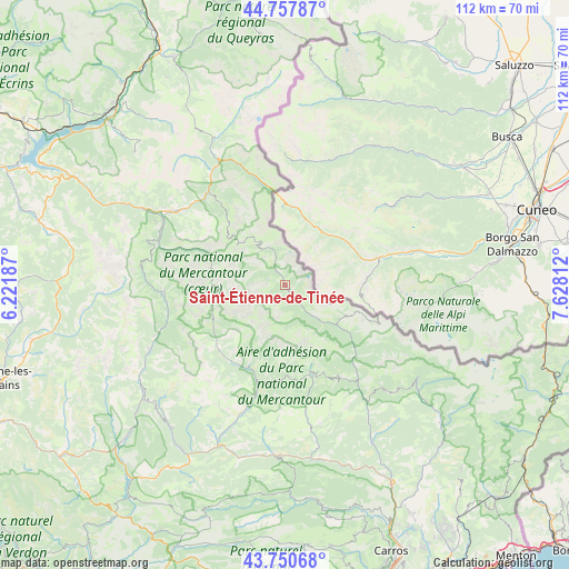
Saint-Étienne-de-Tinée GPS coordinates[2]
44° 15' 23.148" North, 6° 55' 29.964" East
| Map corner | latitude | longitude |
|---|---|---|
| Upper-left | 44.75787°, | 6.22187° |
| Center: | 44.25643°, | 6.92499° |
| Lower-right: | 43.75068°, | 7.62812° |
| Map W x H: | 112×112 km | = 69.6×69.6mi |
| max Lat: | 51.07786° ⇑85.1% North |
| Saint-Étienne-de-Tinée: | 44.25643° |
| min Lat: | ⇓14.9% South 41.3874° |
| min Long | Saint-Étienne- | max Long |
| -5.08615° | 6.92499° | 9.52242° |
| W 94.4%⇐ | ⇒5.6% E |
Elevation
Elevation of Saint-Étienne-de-Tinée is 1140 m = 3740 ft, and this is 946.3 m = 3105 ft above average elevation for this country.
| Max E: |
2333 m = 7654 ft | 0.5% |
| Saint-Étienne-de-Tinée | 1140 m 3740 ft | |
| Avg. | 193.7 m = 635 ft | |
Min E: |
-1 m = -3 ft | 99.5% |
See also: France elevation on elevation.city.
Geographical zone
Saint-Étienne-de-Tinée is located in North temperate zone (between Tropic of Cancer and the Arctic Circle). Distance of this Northern Tropic circle is 2314.9 km =1438.4 mi to South.| Distance of | km | miles | from Saint-Étienne-de-Tinée |
|---|---|---|---|
| North Pole | 5086.2 | 3160.4 | to North |
| Arctic Circle | 2480.3 | 1541.2 | to North |
| Tropic Cancer | 2314.9 | 1438.4 | to South |
| Equator | 4920.9 | 3057.7 | to South |


Nearby cities:
15 places around Saint-Étienne-de-Tinée: (largest is in red/bold)
• Allos
23.7 km =14.7 mi,  265°
265°
• Annot
38.3 km =23.8 mi,  212°
212°
• Barcelonnette
26.1 km =16.2 mi,  303°
303°
• Belvédère
41.5 km =25.8 mi,  130°
130°
• Clans
34 km =21.1 mi,  148°
148°
• Enchastrayes
22.1 km =13.7 mi, 303°
• Entrevaux
35.3 km =21.9 mi,  195°
195°
• Guillaumes
19.3 km =12 mi, 197°
• Isola
12.9 km =8 mi, 127°
• Jausiers
23.7 km =14.7 mi,  318°
318°
• Puget-Théniers
33.5 km =20.8 mi,  184°
184°
• Péone
15.6 km =9.7 mi,  185°
185°
• Roquebillière
40.9 km =25.4 mi, 131°
• Saint-Martin-Vésubie
33.6 km =20.9 mi, 128°
• Villars-sur-Var
38.1 km =23.7 mi,  158°
158°
In other languages:
- In Italian: Santo Stefano di Tinea
- In Russian: Сент-Этьен-де-Тине
- In Chinese: 圣埃蒂安德蒂内埃
Sources, notices
• [Note1] Compared only with cities in France existing in our database
• [Src1] Map data: © OpenStreetMap contributors (CC-BY-SA)
• [Src2] Other city data from geonames.org with taken over terms of usage.
• [Src3] Geographical zone / Annual Mean Temperature by Robert A. Rohde @ Wikipedia
