Beynat geodata
Beynat (Nouvelle-Aquitaine) is a populated place; located in France in Europe/Paris (GMT+2) time zone. With population of 1,233 people, there are 7366 cities with bigger population in this country. Compared to other cities in France, 78.3% of cities are located further ↑North; 60.2% of cities are located further →East and 88.8% of cities have lower elevation than Beynat. Note1
Administrative division(s):
- Level 1: Nouvelle-Aquitaine
- Level 2: Département de la Corrèze
- Level 3: Arrondissement de Brive-la-Gaillarde
- Level 4: Beynat


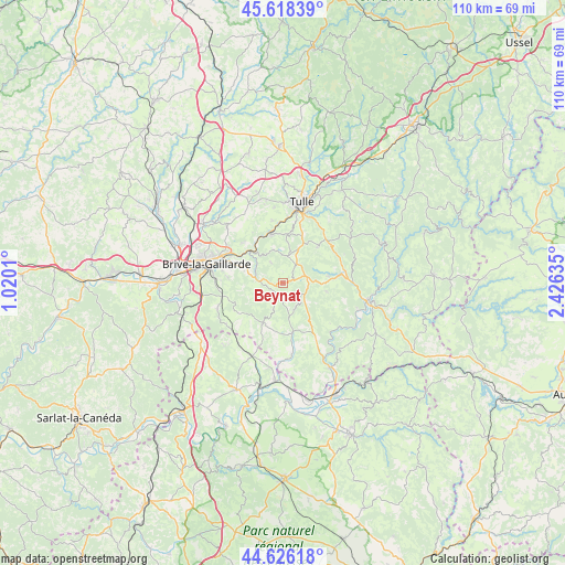
Beynat GPS coordinates[2]
45° 7' 27.984" North, 1° 43' 23.628" East
| Map corner | latitude | longitude |
|---|---|---|
| Upper-left | 45.61839°, | 1.0201° |
| Center: | 45.12444°, | 1.72323° |
| Lower-right: | 44.62618°, | 2.42635° |
| Map W x H: | 110.3×110.3 km | = 68.5×68.5mi |
| max Lat: | 51.07786° ⇑78.3% North |
| Beynat: | 45.12444° |
| min Lat: | ⇓21.7% South 41.3874° |
| min Long | Beynat | max Long |
| -5.08615° | 1.72323° | 9.52242° |
| W 39.8%⇐ | ⇒60.2% E |
Elevation
Elevation of Beynat is 403 m = 1322 ft, and this is 209.3 m = 687 ft above average elevation for this country.
| Max E: |
2333 m = 7654 ft | 11.2% |
| Beynat | 403 m 1322 ft | |
| Avg. | 193.7 m = 635 ft | |
Min E: |
-1 m = -3 ft | 88.8% |
See also: France elevation on elevation.city.
Geographical zone
Beynat is located in North temperate zone (between Tropic of Cancer and the Arctic Circle). Distance of this North polar circle is 2383.8 km =1481.2 mi to North.| Distance of | km | miles | from Beynat |
|---|---|---|---|
| North Pole | 4989.7 | 3100.5 | to North |
| Arctic Circle | 2383.8 | 1481.2 | to North |
| Tropic Cancer | 2411.4 | 1498.4 | to South |
| Equator | 5017.4 | 3117.7 | to South |


Nearby cities:
15 places around Beynat: (largest is in red/bold)
• Albussac
9 km =5.6 mi,  80°
80°
• Aubazine
6.9 km =4.3 mi,  325°
325°
• Chameyrat
12.3 km =7.6 mi,  350°
350°
• Cornil
9.9 km =6.2 mi, 345°
• Cosnac
10.9 km =6.8 mi,  275°
275°
• Dampniat
8.7 km =5.4 mi,  304°
304°
• Jugeals-Nazareth
13.7 km =8.5 mi,  249°
249°
• Lagarde-Enval
9.6 km =6 mi,  43°
43°
• Laguenne
13.9 km =8.6 mi,  19°
19°
• Malemort-sur-Corrèze
13.5 km =8.4 mi,  292°
292°
• Meyssac
8.6 km =5.3 mi,  206°
206°
• Saint-Chamant
13.5 km =8.4 mi,  89°
89°
• Saint-Hilaire-Peyroux
11.5 km =7.1 mi, 329°
• Sainte-Fortunade
9.9 km =6.2 mi, 22°
• Turenne
13.5 km =8.4 mi,  234°
234°
Sources, notices
• [Note1] Compared only with cities in France existing in our database
• [Src1] Map data: © OpenStreetMap contributors (CC-BY-SA)
• [Src2] Other city data from geonames.org with taken over terms of usage.
• [Src3] Geographical zone / Annual Mean Temperature by Robert A. Rohde @ Wikipedia
