Sainte-Colombe geodata
Sainte-Colombe (Nouvelle-Aquitaine) is a populated place; located in France in Europe/Paris (GMT+2) time zone. With population of 587 people, there are 13526 cities with bigger population in this country. Compared to other cities in France, 90.7% of cities are located further ↑North; 84% of cities are located further →East and 64.9% of cities have higher elevation than Sainte-Colombe. Note1
Administrative division(s):
- Level 1: Nouvelle-Aquitaine
- Level 2: Landes
- Level 3: Arrondissement de Mont-de-Marsan
- Level 4: Sainte-Colombe


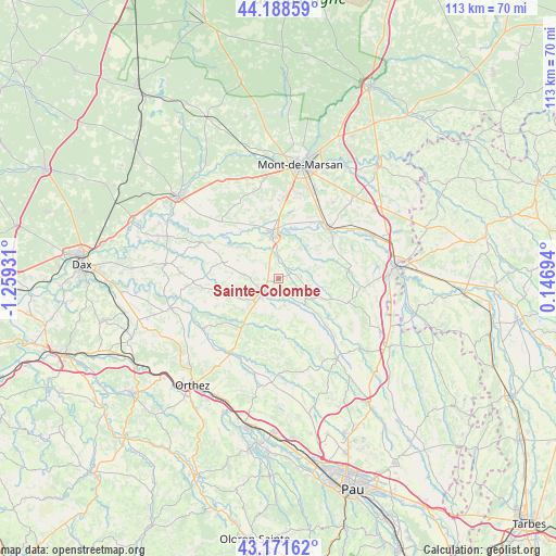
Sainte-Colombe GPS coordinates[2]
43° 40' 56.136" North, 0° 33' 22.284" West
| Map corner | latitude | longitude |
|---|---|---|
| Upper-left | 44.18859°, | -1.25931° |
| Center: | 43.68226°, | -0.55619° |
| Lower-right: | 43.17162°, | 0.14694° |
| Map W x H: | 113.1×113.1 km | = 70.3×70.3mi |
| max Lat: | 51.07786° ⇑90.7% North |
| Sainte-Colombe: | 43.68226° |
| min Lat: | ⇓9.3% South 41.3874° |
| min Long | Sainte-Colombe | max Long |
| -5.08615° | -0.55619° | 9.52242° |
| W 16%⇐ | ⇒84% E |
Elevation
Elevation of Sainte-Colombe is 90 m = 295 ft, and this is 103.7 m = 340 ft below average elevation for this country.
| Max E: |
2333 m = 7654 ft | 64.9% |
| Avg. | 193.7 m = 635 ft | |
| Sainte-Colombe | 90 m = 295 ft | |
Min E: |
-1 m = -3 ft | 35.1% |
See also: France elevation on elevation.city.
Geographical zone
Sainte-Colombe is located in North temperate zone (between Tropic of Cancer and the Arctic Circle). Distance of this Northern Tropic circle is 2251.1 km =1398.8 mi to South.| Distance of | km | miles | from Sainte-Colombe |
|---|---|---|---|
| North Pole | 5150 | 3200.1 | to North |
| Arctic Circle | 2544.2 | 1580.9 | to North |
| Tropic Cancer | 2251.1 | 1398.8 | to South |
| Equator | 4857 | 3018 | to South |


Nearby cities:
15 places around Sainte-Colombe: (largest is in red/bold)
• Aurice
15.2 km =9.4 mi,  345°
345°
• Doazit
7.3 km =4.5 mi,  277°
277°
• Eugénie-les-Bains
14.4 km =8.9 mi,  83°
83°
• Geaune
15 km =9.3 mi,  107°
107°
• Grenade-sur-l’Adour
14.7 km =9.1 mi,  43°
43°
• Hagetmau
3.9 km =2.4 mi,  227°
227°
• Horsarrieu
3.3 km =2.1 mi,  271°
271°
• Larrivière-Saint-Savin
14.6 km =9.1 mi,  50°
50°
• Montaut
10.2 km =6.3 mi,  308°
308°
• Montgaillard
8.9 km =5.5 mi, 41°
• Montsoué
6.8 km =4.2 mi,  34°
34°
• Saint-Cricq-Chalosse
10.8 km =6.7 mi,  253°
253°
• Saint-Maurice-sur-Adour
13.5 km =8.4 mi, 32°
• Saint-Sever
8.5 km =5.3 mi, 350°
• Samadet
7.4 km =4.6 mi,  132°
132°
Sources, notices
• [Note1] Compared only with cities in France existing in our database
• [Src1] Map data: © OpenStreetMap contributors (CC-BY-SA)
• [Src2] Other city data from geonames.org with taken over terms of usage.
• [Src3] Geographical zone / Annual Mean Temperature by Robert A. Rohde @ Wikipedia
