Saint-Aubin-du-Plain geodata
Saint-Aubin-du-Plain (Nouvelle-Aquitaine) is a populated place; located in France in Europe/Paris (GMT+2) time zone. With population of 578 people, there are 13683 cities with bigger population in this country. Compared to other cities in France, 56% of cities are located further ↑North; 83% of cities are located further →East and 55% of cities have lower elevation than Saint-Aubin-du-Plain. Note1
Administrative division(s):
- Level 1: Nouvelle-Aquitaine
- Level 2: Département des Deux-Sèvres
- Level 3: Arrondissement de Bressuire
- Level 4: Saint-Aubin-du-Plain


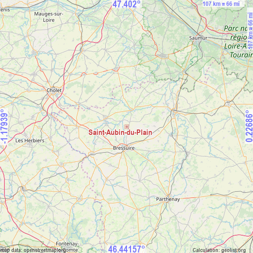
Saint-Aubin-du-Plain GPS coordinates[2]
46° 55' 26.184" North, 0° 28' 34.536" West
| Map corner | latitude | longitude |
|---|---|---|
| Upper-left | 47.402°, | -1.17939° |
| Center: | 46.92394°, | -0.47626° |
| Lower-right: | 46.44157°, | 0.22686° |
| Map W x H: | 106.8×106.8 km | = 66.4×66.4mi |
| max Lat: | 51.07786° ⇑56% North |
| Saint-Aubin-du-Plain: | 46.92394° |
| min Lat: | ⇓44% South 41.3874° |
| min Long | Saint-Aubin-du- | max Long |
| -5.08615° | -0.47626° | 9.52242° |
| W 17%⇐ | ⇒83% E |
Elevation
Elevation of Saint-Aubin-du-Plain is 150 m = 492 ft, and this is 43.7 m = 143 ft below average elevation for this country.
| Max E: |
2333 m = 7654 ft | 45% |
| Avg. | 193.7 m = 635 ft | |
| Saint-Aubin-du-Plain | 150 m = 492 ft | |
Min E: |
-1 m = -3 ft | 55% |
See also: France elevation on elevation.city.
Geographical zone
Saint-Aubin-du-Plain is located in North temperate zone (between Tropic of Cancer and the Arctic Circle). Distance of this North polar circle is 2183.7 km =1356.9 mi to North.| Distance of | km | miles | from Saint-Aubin-du-Plain |
|---|---|---|---|
| North Pole | 4789.6 | 2976.1 | to North |
| Arctic Circle | 2183.7 | 1356.9 | to North |
| Tropic Cancer | 2611.5 | 1622.7 | to South |
| Equator | 5217.5 | 3242 | to South |


Nearby cities:
15 places around Saint-Aubin-du-Plain: (largest is in red/bold)
• Argenton-les-Vallées
7.1 km =4.4 mi,  16°
16°
• Boësse
5.8 km =3.6 mi,  2°
2°
• Bressuire
9.2 km =5.7 mi,  186°
186°
• Bretignolles
12 km =7.5 mi,  235°
235°
• Cersay
16.4 km =10.2 mi,  34°
34°
• Chiché
16.7 km =10.4 mi,  147°
147°
• Faye-l’Abbesse
14 km =8.7 mi,  137°
137°
• Le Pin
15.2 km =9.4 mi, 243°
• Massais
13.5 km =8.4 mi,  47°
47°
• Mauzé-Thouarsais
16.1 km =10 mi,  68°
68°
• Moutiers-sous-Argenton
7.2 km =4.5 mi,  62°
62°
• Nueil-les-Aubiers
8.2 km =5.1 mi,  277°
277°
• Saint-Maurice
12.5 km =7.8 mi,  348°
348°
• Somloire
15.6 km =9.7 mi,  320°
320°
• Voulmentin
3.6 km =2.2 mi,  307°
307°
Sources, notices
• [Note1] Compared only with cities in France existing in our database
• [Src1] Map data: © OpenStreetMap contributors (CC-BY-SA)
• [Src2] Other city data from geonames.org with taken over terms of usage.
• [Src3] Geographical zone / Annual Mean Temperature by Robert A. Rohde @ Wikipedia
