Faye-l’Abbesse geodata
Faye-l’Abbesse (Nouvelle-Aquitaine) is a populated place; located in France in Europe/Paris (GMT+2) time zone. With population of 566 people, there are 13895 cities with bigger population in this country. Compared to other cities in France, 56.9% of cities are located further ↑North; 81.4% of cities are located further →East and 57.1% of cities have lower elevation than Faye-l’Abbesse. Note1
Administrative division(s):
- Level 1: Nouvelle-Aquitaine
- Level 2: Département des Deux-Sèvres
- Level 3: Arrondissement de Bressuire
- Level 4: Faye-l'Abbesse


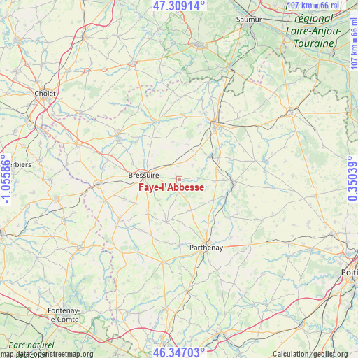
Faye-l’Abbesse GPS coordinates[2]
46° 49' 48.864" North, 0° 21' 9.828" West
| Map corner | latitude | longitude |
|---|---|---|
| Upper-left | 47.30914°, | -1.05586° |
| Center: | 46.83024°, | -0.35273° |
| Lower-right: | 46.34703°, | 0.35039° |
| Map W x H: | 107×107 km | = 66.5×66.5mi |
| max Lat: | 51.07786° ⇑56.9% North |
| Faye-l’Abbesse: | 46.83024° |
| min Lat: | ⇓43.1% South 41.3874° |
| min Long | Faye-l’Abbess | max Long |
| -5.08615° | -0.35273° | 9.52242° |
| W 18.6%⇐ | ⇒81.4% E |
Elevation
Elevation of Faye-l’Abbesse is 158 m = 518 ft, and this is 35.7 m = 117 ft below average elevation for this country.
| Max E: |
2333 m = 7654 ft | 42.9% |
| Avg. | 193.7 m = 635 ft | |
| Faye-l’Abbesse | 158 m = 518 ft | |
Min E: |
-1 m = -3 ft | 57.1% |
See also: France elevation on elevation.city.
Geographical zone
Faye-l’Abbesse is located in North temperate zone (between Tropic of Cancer and the Arctic Circle). Distance of this North polar circle is 2194.1 km =1363.4 mi to North.| Distance of | km | miles | from Faye-l’Abbesse |
|---|---|---|---|
| North Pole | 4800 | 2982.6 | to North |
| Arctic Circle | 2194.1 | 1363.4 | to North |
| Tropic Cancer | 2601.1 | 1616.2 | to South |
| Equator | 5207 | 3235.5 | to South |


Nearby cities:
15 places around Faye-l’Abbesse: (largest is in red/bold)
• Airvault
16.3 km =10.1 mi,  91°
91°
• Amailloux
9.7 km =6 mi,  163°
163°
• Boismé
8.8 km =5.5 mi,  225°
225°
• Bressuire
10.5 km =6.5 mi,  276°
276°
• Chanteloup
14.8 km =9.2 mi,  241°
241°
• Chiché
3.7 km =2.3 mi,  188°
188°
• Clessé
13.4 km =8.3 mi,  197°
197°
• Glénay
8.4 km =5.2 mi,  66°
66°
• La Chapelle-Saint-Laurent
13.3 km =8.3 mi, 225°
• Louin
14.9 km =9.3 mi,  101°
101°
• Luzay
15.8 km =9.8 mi,  49°
49°
• Mauzé-Thouarsais
17.2 km =10.7 mi,  19°
19°
• Moutiers-sous-Argenton
14.1 km =8.8 mi,  347°
347°
• Saint-Aubin-du-Plain
14 km =8.7 mi,  317°
317°
• Saint-Varent
11.3 km =7 mi, 54°
Sources, notices
• [Note1] Compared only with cities in France existing in our database
• [Src1] Map data: © OpenStreetMap contributors (CC-BY-SA)
• [Src2] Other city data from geonames.org with taken over terms of usage.
• [Src3] Geographical zone / Annual Mean Temperature by Robert A. Rohde @ Wikipedia
