Sermoyer geodata
Sermoyer (Auvergne-Rhône-Alpes) is a populated place; located in France in Europe/Paris (GMT+2) time zone. With population of 595 people, there are 13406 cities with bigger population in this country. Compared to other cities in France, 60.1% of cities are located further ↑North; 77.4% of cities are located further ←West and 64.6% of cities have lower elevation than Sermoyer. Note1
Administrative division(s):
- Level 1: Auvergne-Rhône-Alpes
- Level 2: Département de l'Ain
- Level 3: Arrondissement de Bourg-en-Bresse
- Level 4: Sermoyer


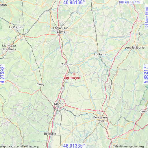
Sermoyer GPS coordinates[2]
46° 29' 58.236" North, 4° 58' 44.58" East
| Map corner | latitude | longitude |
|---|---|---|
| Upper-left | 46.98136°, | 4.27592° |
| Center: | 46.49951°, | 4.97905° |
| Lower-right: | 46.01335°, | 5.68217° |
| Map W x H: | 107.6×107.6 km | = 66.9×66.9mi |
| max Lat: | 51.07786° ⇑60.1% North |
| Sermoyer: | 46.49951° |
| min Lat: | ⇓39.9% South 41.3874° |
| min Long | Sermoyer | max Long |
| -5.08615° | 4.97905° | 9.52242° |
| W 77.4%⇐ | ⇒22.6% E |
Elevation
Elevation of Sermoyer is 192 m = 630 ft, and this is 1.7 m = 6 ft below average elevation for this country.
| Max E: |
2333 m = 7654 ft | 35.4% |
| Avg. | 193.7 m = 635 ft | |
| Sermoyer | 192 m = 630 ft | |
Min E: |
-1 m = -3 ft | 64.6% |
See also: France elevation on elevation.city.
Geographical zone
Sermoyer is located in North temperate zone (between Tropic of Cancer and the Arctic Circle). Distance of this North polar circle is 2230.9 km =1386.2 mi to North.| Distance of | km | miles | from Sermoyer |
|---|---|---|---|
| North Pole | 4836.8 | 3005.4 | to North |
| Arctic Circle | 2230.9 | 1386.2 | to North |
| Tropic Cancer | 2564.3 | 1593.4 | to South |
| Equator | 5170.3 | 3212.7 | to South |


Nearby cities:
15 places around Sermoyer: (largest is in red/bold)
• Chavannes-sur-Reyssouze
7.7 km =4.8 mi,  169°
169°
• Cuisery
6.5 km =4 mi,  12°
12°
• Gorrevod
9.3 km =5.8 mi,  196°
196°
• Lacrost
7.4 km =4.6 mi,  331°
331°
• Loisy
9.8 km =6.1 mi,  22°
22°
• Montbellet
8.5 km =5.3 mi,  252°
252°
• Plottes
8.7 km =5.4 mi,  292°
292°
• Pont-de-Vaux
7.8 km =4.8 mi, 199°
• Préty
5.6 km =3.5 mi, 329°
• Reyssouze
8.5 km =5.3 mi,  211°
211°
• Romenay
6.9 km =4.3 mi,  87°
87°
• Saint-Bénigne
6.7 km =4.2 mi,  184°
184°
• Saint-Trivier-de-Courtes
8.7 km =5.4 mi,  120°
120°
• Tournus
9.4 km =5.8 mi,  323°
323°
• Uchizy
7.2 km =4.5 mi,  273°
273°
Sources, notices
• [Note1] Compared only with cities in France existing in our database
• [Src1] Map data: © OpenStreetMap contributors (CC-BY-SA)
• [Src2] Other city data from geonames.org with taken over terms of usage.
• [Src3] Geographical zone / Annual Mean Temperature by Robert A. Rohde @ Wikipedia
