Romenay geodata
Romenay (Bourgogne-Franche-Comté) is a populated place; located in France in Europe/Paris (GMT+2) time zone. With population of 1,599 people, there are 5836 cities with bigger population in this country. Compared to other cities in France, 60.1% of cities are located further ↑North; 78.4% of cities are located further ←West and 68.1% of cities have lower elevation than Romenay. Note1
Administrative division(s):
- Level 1: Bourgogne-Franche-Comté
- Level 2: Département de Saône-et-Loire
- Level 3: Arrondissement de Louhans
- Level 4: Romenay


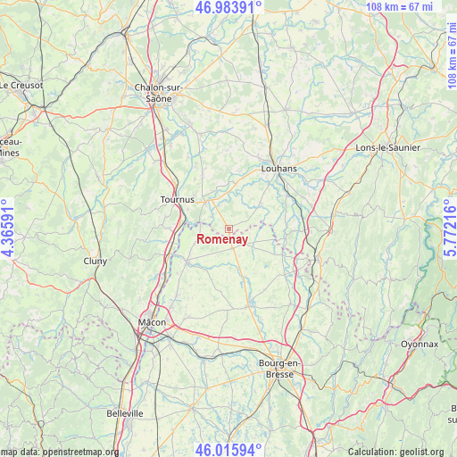
Romenay GPS coordinates[2]
46° 30' 7.488" North, 5° 4' 8.544" East
| Map corner | latitude | longitude |
|---|---|---|
| Upper-left | 46.98391°, | 4.36591° |
| Center: | 46.50208°, | 5.06904° |
| Lower-right: | 46.01594°, | 5.77216° |
| Map W x H: | 107.6×107.6 km | = 66.9×66.9mi |
| max Lat: | 51.07786° ⇑60.1% North |
| Romenay: | 46.50208° |
| min Lat: | ⇓39.9% South 41.3874° |
| min Long | Romenay | max Long |
| -5.08615° | 5.06904° | 9.52242° |
| W 78.4%⇐ | ⇒21.6% E |
Elevation
Elevation of Romenay is 210 m = 689 ft, and this is 16.3 m = 53 ft above average elevation for this country.
| Max E: |
2333 m = 7654 ft | 31.9% |
| Romenay | 210 m 689 ft | |
| Avg. | 193.7 m = 635 ft | |
Min E: |
-1 m = -3 ft | 68.1% |
See also: France elevation on elevation.city.
Geographical zone
Romenay is located in North temperate zone (between Tropic of Cancer and the Arctic Circle). Distance of this North polar circle is 2230.6 km =1386 mi to North.| Distance of | km | miles | from Romenay |
|---|---|---|---|
| North Pole | 4836.5 | 3005.3 | to North |
| Arctic Circle | 2230.6 | 1386 | to North |
| Tropic Cancer | 2564.6 | 1593.6 | to South |
| Equator | 5170.5 | 3212.8 | to South |


Nearby cities:
15 places around Romenay: (largest is in red/bold)
• Chavannes-sur-Reyssouze
9.6 km =6 mi,  215°
215°
• Cuisery
8.2 km =5.1 mi,  318°
318°
• Lacrost
12.2 km =7.6 mi,  300°
300°
• Lescheroux
12.2 km =7.6 mi,  151°
151°
• Loisy
9.4 km =5.8 mi,  339°
339°
• Montpont-en-Bresse
9.5 km =5.9 mi,  50°
50°
• Pont-de-Vaux
12.2 km =7.6 mi,  231°
231°
• Préty
10.7 km =6.6 mi, 295°
• Rancy
10.7 km =6.6 mi,  9°
9°
• Saint-Bénigne
10.2 km =6.3 mi, 226°
• Saint-Jean-sur-Reyssouze
11.8 km =7.3 mi,  182°
182°
• Saint-Julien-sur-Reyssouze
11.4 km =7.1 mi,  164°
164°
• Saint-Nizier-le-Bouchoux
7.7 km =4.8 mi,  126°
126°
• Saint-Trivier-de-Courtes
4.7 km =2.9 mi,  172°
172°
• Sermoyer
6.9 km =4.3 mi,  267°
267°
Sources, notices
• [Note1] Compared only with cities in France existing in our database
• [Src1] Map data: © OpenStreetMap contributors (CC-BY-SA)
• [Src2] Other city data from geonames.org with taken over terms of usage.
• [Src3] Geographical zone / Annual Mean Temperature by Robert A. Rohde @ Wikipedia
