Pradines geodata
Pradines (Auvergne-Rhône-Alpes) is a populated place; located in France in Europe/Paris (GMT+2) time zone. With population of 624 people, there are 12917 cities with bigger population in this country. Compared to other cities in France, 66.3% of cities are located further ↑North; 69.5% of cities are located further ←West and 89.5% of cities have lower elevation than Pradines. Note1
Administrative division(s):
- Level 1: Auvergne-Rhône-Alpes
- Level 2: Département de la Loire
- Level 3: Arrondissement de Roanne
- Level 4: Pradines


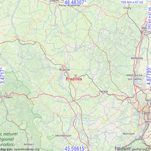
Pradines GPS coordinates[2]
45° 59' 48.372" North, 4° 10' 29.388" East
| Map corner | latitude | longitude |
|---|---|---|
| Upper-left | 46.48307°, | 3.4717° |
| Center: | 45.99677°, | 4.17483° |
| Lower-right: | 45.50615°, | 4.87795° |
| Map W x H: | 108.6×108.6 km | = 67.5×67.5mi |
| max Lat: | 51.07786° ⇑66.3% North |
| Pradines: | 45.99677° |
| min Lat: | ⇓33.7% South 41.3874° |
| min Long | Pradines | max Long |
| -5.08615° | 4.17483° | 9.52242° |
| W 69.5%⇐ | ⇒30.5% E |
Elevation
Elevation of Pradines is 415 m = 1362 ft, and this is 221.3 m = 726 ft above average elevation for this country.
| Max E: |
2333 m = 7654 ft | 10.5% |
| Pradines | 415 m 1362 ft | |
| Avg. | 193.7 m = 635 ft | |
Min E: |
-1 m = -3 ft | 89.5% |
See also: France elevation on elevation.city.
Geographical zone
Pradines is located in North temperate zone (between Tropic of Cancer and the Arctic Circle). Distance of this North polar circle is 2286.8 km =1421 mi to North.| Distance of | km | miles | from Pradines |
|---|---|---|---|
| North Pole | 4892.7 | 3040.2 | to North |
| Arctic Circle | 2286.8 | 1421 | to North |
| Tropic Cancer | 2508.4 | 1558.6 | to South |
| Equator | 5114.4 | 3177.9 | to South |


Nearby cities:
15 places around Pradines: (largest is in red/bold)
• Bourg-de-Thizy
10.4 km =6.5 mi,  66°
66°
• Commelle
9 km =5.6 mi,  272°
272°
• Coutouvre
8.8 km =5.5 mi,  15°
15°
• Fourneaux
9.8 km =6.1 mi,  130°
130°
• Lay
5.7 km =3.5 mi,  147°
147°
• Le Coteau
6.8 km =4.2 mi,  291°
291°
• Notre-Dame-de-Boisset
3.2 km =2 mi,  277°
277°
• Parigny
5.7 km =3.5 mi,  264°
264°
• Perreux
6.1 km =3.8 mi,  322°
322°
• Roanne
9.3 km =5.8 mi,  298°
298°
• Régny
3.3 km =2.1 mi,  101°
101°
• Saint-Cyr-de-Favières
7.4 km =4.6 mi,  243°
243°
• Saint-Symphorien-de-Lay
6.2 km =3.9 mi, 151°
• Saint-Victor-sur-Rhins
8.4 km =5.2 mi,  84°
84°
• Saint-Vincent-de-Boisset
4.2 km =2.6 mi, 286°
Sources, notices
• [Note1] Compared only with cities in France existing in our database
• [Src1] Map data: © OpenStreetMap contributors (CC-BY-SA)
• [Src2] Other city data from geonames.org with taken over terms of usage.
• [Src3] Geographical zone / Annual Mean Temperature by Robert A. Rohde @ Wikipedia
