Lay geodata
Lay (Auvergne-Rhône-Alpes) is a populated place; located in France in Europe/Paris (GMT+2) time zone. With population of 663 people, there are 12328 cities with bigger population in this country. Compared to other cities in France, 66.8% of cities are located further ↑North; 69.8% of cities are located further ←West and 90.7% of cities have lower elevation than Lay. Note1
Administrative division(s):
- Level 1: Auvergne-Rhône-Alpes
- Level 2: Département de la Loire
- Level 3: Arrondissement de Roanne
- Level 4: Lay


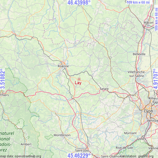
Lay GPS coordinates[2]
45° 57' 11.844" North, 4° 12' 50.184" East
| Map corner | latitude | longitude |
|---|---|---|
| Upper-left | 46.43998°, | 3.51082° |
| Center: | 45.95329°, | 4.21394° |
| Lower-right: | 45.46229°, | 4.91707° |
| Map W x H: | 108.7×108.7 km | = 67.5×67.5mi |
| max Lat: | 51.07786° ⇑66.8% North |
| Lay: | 45.95329° |
| min Lat: | ⇓33.2% South 41.3874° |
| min Long | Lay | max Long |
| -5.08615° | 4.21394° | 9.52242° |
| W 69.8%⇐ | ⇒30.2% E |
Elevation
Elevation of Lay is 441 m = 1447 ft, and this is 247.3 m = 811 ft above average elevation for this country.
| Max E: |
2333 m = 7654 ft | 9.3% |
| Lay | 441 m 1447 ft | |
| Avg. | 193.7 m = 635 ft | |
Min E: |
-1 m = -3 ft | 90.7% |
See also: France elevation on elevation.city.
Geographical zone
Lay is located in North temperate zone (between Tropic of Cancer and the Arctic Circle). Distance of this North polar circle is 2291.6 km =1423.9 mi to North.| Distance of | km | miles | from Lay |
|---|---|---|---|
| North Pole | 4897.5 | 3043.2 | to North |
| Arctic Circle | 2291.6 | 1423.9 | to North |
| Tropic Cancer | 2503.6 | 1555.7 | to South |
| Equator | 5109.5 | 3174.9 | to South |


Nearby cities:
15 places around Lay: (largest is in red/bold)
• Amplepuis
9.2 km =5.7 mi,  76°
76°
• Fourneaux
4.7 km =2.9 mi,  109°
109°
• Neulise
6.6 km =4.1 mi,  202°
202°
• Notre-Dame-de-Boisset
8.2 km =5.1 mi,  310°
310°
• Parigny
9.7 km =6 mi,  296°
296°
• Pradines
5.7 km =3.5 mi,  327°
327°
• Régny
4.2 km =2.6 mi,  2°
2°
• Saint-Cyr-de-Favières
9.7 km =6 mi,  279°
279°
• Saint-Jean-la-Bussière
10 km =6.2 mi,  58°
58°
• Saint-Jodard
10.4 km =6.5 mi,  218°
218°
• Saint-Just-la-Pendue
6.9 km =4.3 mi,  162°
162°
• Saint-Marcel-de-Félines
9.7 km =6 mi,  190°
190°
• Saint-Symphorien-de-Lay
0.6 km =0.4 mi, 185°
• Saint-Victor-sur-Rhins
7.7 km =4.8 mi,  43°
43°
• Saint-Vincent-de-Boisset
9.3 km =5.8 mi, 310°
Sources, notices
• [Note1] Compared only with cities in France existing in our database
• [Src1] Map data: © OpenStreetMap contributors (CC-BY-SA)
• [Src2] Other city data from geonames.org with taken over terms of usage.
• [Src3] Geographical zone / Annual Mean Temperature by Robert A. Rohde @ Wikipedia
