Saint-Symphorien-de-Lay geodata
Saint-Symphorien-de-Lay (Auvergne-Rhône-Alpes) is a populated place; located in France in Europe/Paris (GMT+2) time zone. With population of 1,449 people, there are 6391 cities with bigger population in this country. Compared to other cities in France, 66.9% of cities are located further ↑North; 69.8% of cities are located further ←West and 90.7% of cities have lower elevation than Saint-Symphorien-de-Lay. Note1
Administrative division(s):
- Level 1: Auvergne-Rhône-Alpes
- Level 2: Département de la Loire
- Level 3: Arrondissement de Roanne
- Level 4: Saint-Symphorien-de-Lay
Current local time in Saint-Symphorien-de-Lay:
12:02 PM, SaturdayDifference from your time zone: hours


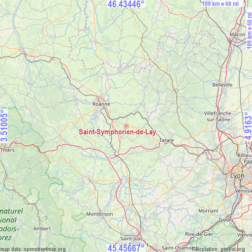
Saint-Symphorien-de-Lay GPS coordinates[2]
45° 56' 51.792" North, 4° 12' 47.448" East
| Map corner | latitude | longitude |
|---|---|---|
| Upper-left | 46.43446°, | 3.51005° |
| Center: | 45.94772°, | 4.21318° |
| Lower-right: | 45.45667°, | 4.9163° |
| Map W x H: | 108.7×108.7 km | = 67.5×67.5mi |
| max Lat: | 51.07786° ⇑66.9% North |
| Saint-Symphorien-de-Lay: | 45.94772° |
| min Lat: | ⇓33.1% South 41.3874° |
| min Long | Saint-Symphorie | max Long |
| -5.08615° | 4.21318° | 9.52242° |
| W 69.8%⇐ | ⇒30.2% E |
Elevation
Elevation of Saint-Symphorien-de-Lay is 442 m = 1450 ft, and this is 248.3 m = 815 ft above average elevation for this country.
| Max E: |
2333 m = 7654 ft | 9.3% |
| Saint-Symphorien-de-Lay | 442 m 1450 ft | |
| Avg. | 193.7 m = 635 ft | |
Min E: |
-1 m = -3 ft | 90.7% |
See also: France elevation on elevation.city.
Geographical zone
Saint-Symphorien-de-Lay is located in North temperate zone (between Tropic of Cancer and the Arctic Circle). Distance of this North polar circle is 2292.3 km =1424.4 mi to North.| Distance of | km | miles | from Saint-Symphorien-de-Lay |
|---|---|---|---|
| North Pole | 4898.2 | 3043.6 | to North |
| Arctic Circle | 2292.3 | 1424.4 | to North |
| Tropic Cancer | 2503 | 1555.3 | to South |
| Equator | 5108.9 | 3174.5 | to South |


Nearby cities:
15 places around Saint-Symphorien-de-Lay: (largest is in red/bold)
• Amplepuis
9.5 km =5.9 mi,  73°
73°
• Fourneaux
4.6 km =2.9 mi,  102°
102°
• Lay
0.6 km =0.4 mi,  5°
5°
• Neulise
6 km =3.7 mi,  204°
204°
• Notre-Dame-de-Boisset
8.5 km =5.3 mi,  313°
313°
• Parigny
9.9 km =6.2 mi,  299°
299°
• Pradines
6.2 km =3.9 mi,  331°
331°
• Régny
4.8 km =3 mi,  3°
3°
• Saint-Cyr-de-Favières
9.8 km =6.1 mi,  282°
282°
• Saint-Jean-la-Bussière
10.3 km =6.4 mi,  55°
55°
• Saint-Jodard
9.9 km =6.2 mi,  220°
220°
• Saint-Just-la-Pendue
6.3 km =3.9 mi,  159°
159°
• Saint-Marcel-de-Félines
9 km =5.6 mi,  190°
190°
• Saint-Victor-sur-Rhins
8.2 km =5.1 mi,  40°
40°
• Saint-Vincent-de-Boisset
9.7 km =6 mi, 313°
Sources, notices
• [Note1] Compared only with cities in France existing in our database
• [Src1] Map data: © OpenStreetMap contributors (CC-BY-SA)
• [Src2] Other city data from geonames.org with taken over terms of usage.
• [Src3] Geographical zone / Annual Mean Temperature by Robert A. Rohde @ Wikipedia
