Saint-Vincent-de-Boisset geodata
Saint-Vincent-de-Boisset (Auvergne-Rhône-Alpes) is a populated place; located in France in Europe/Paris (GMT+2) time zone. With population of 913 people, there are 9550 cities with bigger population in this country. Compared to other cities in France, 66.1% of cities are located further ↑North; 69% of cities are located further ←West and 86.6% of cities have lower elevation than Saint-Vincent-de-Boisset. Note1
Administrative division(s):
- Level 1: Auvergne-Rhône-Alpes
- Level 2: Département de la Loire
- Level 3: Arrondissement de Roanne
- Level 4: Saint-Vincent-de-Boisset
Current local time in Saint-Vincent-de-Boisset:
11:52 AM, SaturdayDifference from your time zone: hours


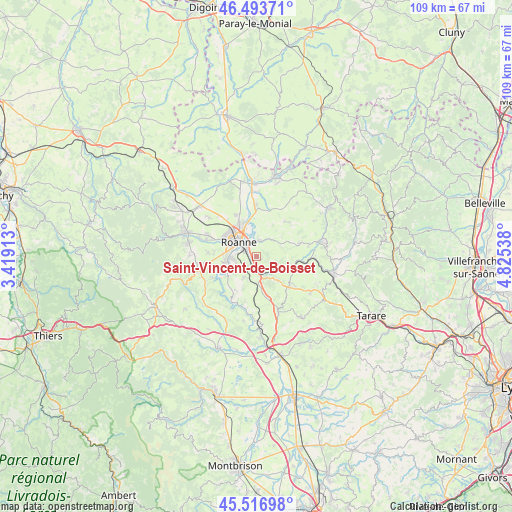
Saint-Vincent-de-Boisset GPS coordinates[2]
46° 0' 27" North, 4° 7' 20.136" East
| Map corner | latitude | longitude |
|---|---|---|
| Upper-left | 46.49371°, | 3.41913° |
| Center: | 46.0075°, | 4.12226° |
| Lower-right: | 45.51698°, | 4.82538° |
| Map W x H: | 108.6×108.6 km | = 67.5×67.5mi |
| max Lat: | 51.07786° ⇑66.1% North |
| Saint-Vincent-de-Boisset: | 46.0075° |
| min Lat: | ⇓33.9% South 41.3874° |
| min Long | Saint-Vincent-d | max Long |
| -5.08615° | 4.12226° | 9.52242° |
| W 69%⇐ | ⇒31% E |
Elevation
Elevation of Saint-Vincent-de-Boisset is 368 m = 1207 ft, and this is 174.3 m = 572 ft above average elevation for this country.
| Max E: |
2333 m = 7654 ft | 13.4% |
| Saint-Vincent-de-Boisset | 368 m 1207 ft | |
| Avg. | 193.7 m = 635 ft | |
Min E: |
-1 m = -3 ft | 86.6% |
See also: France elevation on elevation.city.
Geographical zone
Saint-Vincent-de-Boisset is located in North temperate zone (between Tropic of Cancer and the Arctic Circle). Distance of this North polar circle is 2285.6 km =1420.2 mi to North.| Distance of | km | miles | from Saint-Vincent-de-Boisset |
|---|---|---|---|
| North Pole | 4891.5 | 3039.4 | to North |
| Arctic Circle | 2285.6 | 1420.2 | to North |
| Tropic Cancer | 2509.6 | 1559.4 | to South |
| Equator | 5115.6 | 3178.7 | to South |


Nearby cities:
15 places around Saint-Vincent-de-Boisset: (largest is in red/bold)
• Commelle
5 km =3.1 mi,  261°
261°
• Cordelle
8.5 km =5.3 mi,  213°
213°
• Coutouvre
9.7 km =6 mi,  41°
41°
• Lay
9.3 km =5.8 mi,  130°
130°
• Le Coteau
2.7 km =1.7 mi,  299°
299°
• Mably
8 km =5 mi,  323°
323°
• Notre-Dame-de-Boisset
1.1 km =0.7 mi, 130°
• Parigny
2.3 km =1.4 mi,  222°
222°
• Perreux
3.6 km =2.2 mi,  5°
5°
• Pradines
4.2 km =2.6 mi,  106°
106°
• Riorges
7.4 km =4.6 mi, 303°
• Roanne
5.3 km =3.3 mi,  307°
307°
• Régny
7.5 km =4.7 mi,  104°
104°
• Saint-Cyr-de-Favières
5.1 km =3.2 mi, 209°
• Villerest
6.9 km =4.3 mi, 258°
Sources, notices
• [Note1] Compared only with cities in France existing in our database
• [Src1] Map data: © OpenStreetMap contributors (CC-BY-SA)
• [Src2] Other city data from geonames.org with taken over terms of usage.
• [Src3] Geographical zone / Annual Mean Temperature by Robert A. Rohde @ Wikipedia
