Ploërdut geodata
Ploërdut (Brittany) is a populated place; located in France in Europe/Paris (GMT+2) time zone. With population of 1,400 people, there are 6605 cities with bigger population in this country. Compared to other cities in France, 60.9% of cities are located further ↓South; 97.9% of cities are located further →East and 65.4% of cities have lower elevation than Ploërdut. Note1
Administrative division(s):
- Level 1: Brittany
- Level 2: Morbihan
- Level 3: Arrondissement de Pontivy
- Level 4: Ploërdut


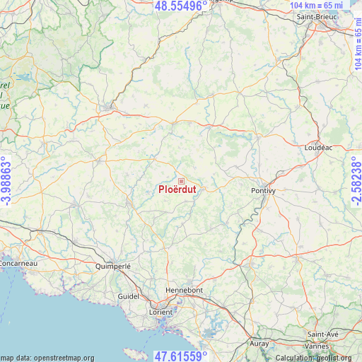
Ploërdut GPS coordinates[2]
48° 5' 14.712" North, 3° 17' 7.8" West
| Map corner | latitude | longitude |
|---|---|---|
| Upper-left | 48.55496°, | -3.98863° |
| Center: | 48.08742°, | -3.2855° |
| Lower-right: | 47.61559°, | -2.58238° |
| Map W x H: | 104.4×104.4 km | = 64.9×64.9mi |
| max Lat: | 51.07786° ⇑39.1% North |
| Ploërdut: | 48.08742° |
| min Lat: | ⇓60.9% South 41.3874° |
| min Long | Ploërdut | max Long |
| -5.08615° | -3.2855° | 9.52242° |
| W 2.1%⇐ | ⇒97.9% E |
Elevation
Elevation of Ploërdut is 196 m = 643 ft, and this is 2.3 m = 8 ft above average elevation for this country.
| Max E: |
2333 m = 7654 ft | 34.6% |
| Ploërdut | 196 m 643 ft | |
| Avg. | 193.7 m = 635 ft | |
Min E: |
-1 m = -3 ft | 65.4% |
See also: France elevation on elevation.city.
Geographical zone
Ploërdut is located in North temperate zone (between Tropic of Cancer and the Arctic Circle). Distance of this North polar circle is 2054.4 km =1276.5 mi to North.| Distance of | km | miles | from Ploërdut |
|---|---|---|---|
| North Pole | 4660.2 | 2895.7 | to North |
| Arctic Circle | 2054.4 | 1276.5 | to North |
| Tropic Cancer | 2740.9 | 1703.1 | to South |
| Equator | 5346.8 | 3322.3 | to South |


Nearby cities:
15 places around Ploërdut: (largest is in red/bold)
• Berné
13.1 km =8.1 mi,  218°
218°
• Bubry
16.2 km =10.1 mi,  148°
148°
• Cléguérec
16.4 km =10.2 mi,  74°
74°
• Guern
15.8 km =9.8 mi,  114°
114°
• Guémené-sur-Scorff
6.8 km =4.2 mi, 109°
• Inguiniel
12.3 km =7.6 mi,  178°
178°
• Langonnet
15.6 km =9.7 mi,  277°
277°
• Le Croisty
6.3 km =3.9 mi,  246°
246°
• Le Faouët
16.4 km =10.2 mi, 248°
• Lignol
5.7 km =3.5 mi,  168°
168°
• Meslan
15 km =9.3 mi,  226°
226°
• Plouray
9.9 km =6.2 mi,  310°
310°
• Plélauff
14.4 km =8.9 mi,  23°
23°
• Priziac
10 km =6.2 mi,  256°
256°
• Séglien
9.6 km =6 mi,  76°
76°
Sources, notices
• [Note1] Compared only with cities in France existing in our database
• [Src1] Map data: © OpenStreetMap contributors (CC-BY-SA)
• [Src2] Other city data from geonames.org with taken over terms of usage.
• [Src3] Geographical zone / Annual Mean Temperature by Robert A. Rohde @ Wikipedia
