Laurenan geodata
Laurenan (Brittany) is a populated place; located in France in Europe/Paris (GMT+2) time zone. With population of 759 people, there are 11065 cities with bigger population in this country. Compared to other cities in France, 62.8% of cities are located further ↓South; 96.3% of cities are located further →East and 61% of cities have lower elevation than Laurenan. Note1
Administrative division(s):
- Level 1: Brittany
- Level 2: Département des Côtes-d’Armor
- Level 3: Arrondissement de Saint-Brieuc
- Level 4: Laurenan


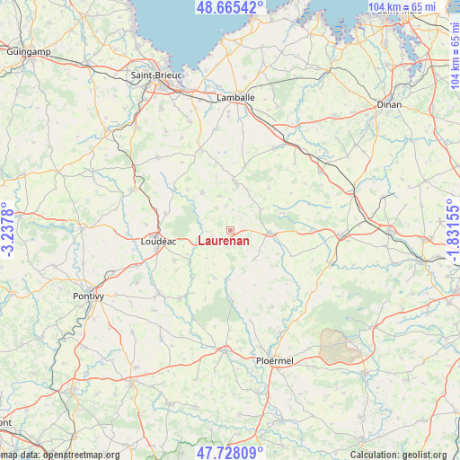
Laurenan GPS coordinates[2]
48° 11' 56.04" North, 2° 32' 4.812" West
| Map corner | latitude | longitude |
|---|---|---|
| Upper-left | 48.66542°, | -3.2378° |
| Center: | 48.1989°, | -2.53467° |
| Lower-right: | 47.72809°, | -1.83155° |
| Map W x H: | 104.2×104.2 km | = 64.7×64.7mi |
| max Lat: | 51.07786° ⇑37.2% North |
| Laurenan: | 48.1989° |
| min Lat: | ⇓62.8% South 41.3874° |
| min Long | Laurenan | max Long |
| -5.08615° | -2.53467° | 9.52242° |
| W 3.7%⇐ | ⇒96.3% E |
Elevation
Elevation of Laurenan is 175 m = 574 ft, and this is 18.7 m = 61 ft below average elevation for this country.
| Max E: |
2333 m = 7654 ft | 39% |
| Avg. | 193.7 m = 635 ft | |
| Laurenan | 175 m = 574 ft | |
Min E: |
-1 m = -3 ft | 61% |
See also: France elevation on elevation.city.
Geographical zone
Laurenan is located in North temperate zone (between Tropic of Cancer and the Arctic Circle). Distance of this North polar circle is 2042 km =1268.8 mi to North.| Distance of | km | miles | from Laurenan |
|---|---|---|---|
| North Pole | 4647.8 | 2888 | to North |
| Arctic Circle | 2042 | 1268.8 | to North |
| Tropic Cancer | 2753.3 | 1710.8 | to South |
| Equator | 5359.2 | 3330.1 | to South |


Nearby cities:
15 places around Laurenan: (largest is in red/bold)
• Collinée
11.2 km =7 mi,  6°
6°
• La Chèze
11.8 km =7.3 mi,  229°
229°
• La Prénessaye
7.7 km =4.8 mi,  256°
256°
• La Trinité-Porhoët
11.3 km =7 mi,  183°
183°
• Langast
13.2 km =8.2 mi,  313°
313°
• Langourla
13 km =8.1 mi,  42°
42°
• Merdrignac
8.9 km =5.5 mi,  93°
93°
• Ménéac
8.5 km =5.3 mi,  140°
140°
• Plessala
10.6 km =6.6 mi,  324°
324°
• Plumieux
11.3 km =7 mi,  198°
198°
• Plémet
5 km =3.1 mi,  239°
239°
• Saint-Barnabé
14.4 km =8.9 mi, 241°
• Saint-Gouéno
8 km =5 mi,  342°
342°
• Saint-Jacut-du-Mené
9.9 km =6.2 mi,  22°
22°
• Saint-Vran
8 km =5 mi,  59°
59°
Sources, notices
• [Note1] Compared only with cities in France existing in our database
• [Src1] Map data: © OpenStreetMap contributors (CC-BY-SA)
• [Src2] Other city data from geonames.org with taken over terms of usage.
• [Src3] Geographical zone / Annual Mean Temperature by Robert A. Rohde @ Wikipedia
