Saint-Gouéno geodata
Saint-Gouéno (Brittany) is a populated place; located in France in Europe/Paris (GMT+2) time zone. With population of 674 people, there are 12156 cities with bigger population in this country. Compared to other cities in France, 64% of cities are located further ↓South; 96.4% of cities are located further →East and 63.8% of cities have lower elevation than Saint-Gouéno. Note1
Administrative division(s):
- Level 1: Brittany
- Level 2: Département des Côtes-d’Armor
- Level 3: Arrondissement de Saint-Brieuc
- Level 4: Le Mené


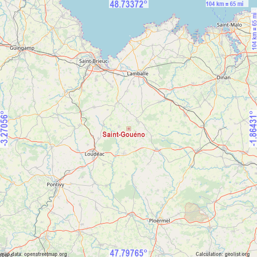
Saint-Gouéno GPS coordinates[2]
48° 16' 4.188" North, 2° 34' 2.748" West
| Map corner | latitude | longitude |
|---|---|---|
| Upper-left | 48.73372°, | -3.27056° |
| Center: | 48.26783°, | -2.56743° |
| Lower-right: | 47.79765°, | -1.86431° |
| Map W x H: | 104.1×104.1 km | = 64.7×64.7mi |
| max Lat: | 51.07786° ⇑36% North |
| Saint-Gouéno: | 48.26783° |
| min Lat: | ⇓64% South 41.3874° |
| min Long | Saint-Gouéno | max Long |
| -5.08615° | -2.56743° | 9.52242° |
| W 3.6%⇐ | ⇒96.4% E |
Elevation
Elevation of Saint-Gouéno is 188 m = 617 ft, and this is 5.7 m = 19 ft below average elevation for this country.
| Max E: |
2333 m = 7654 ft | 36.2% |
| Avg. | 193.7 m = 635 ft | |
| Saint-Gouéno | 188 m = 617 ft | |
Min E: |
-1 m = -3 ft | 63.8% |
See also: France elevation on elevation.city.
Geographical zone
Saint-Gouéno is located in North temperate zone (between Tropic of Cancer and the Arctic Circle). Distance of this North polar circle is 2034.3 km =1264.1 mi to North.| Distance of | km | miles | from Saint-Gouéno |
|---|---|---|---|
| North Pole | 4640.2 | 2883.3 | to North |
| Arctic Circle | 2034.3 | 1264.1 | to North |
| Tropic Cancer | 2761 | 1715.6 | to South |
| Equator | 5366.9 | 3334.8 | to South |


Nearby cities:
15 places around Saint-Gouéno: (largest is in red/bold)
• Collinée
5.1 km =3.2 mi,  46°
46°
• La Prénessaye
10.8 km =6.7 mi,  208°
208°
• Langast
7.2 km =4.5 mi,  281°
281°
• Langourla
11.4 km =7.1 mi,  80°
80°
• Laurenan
8 km =5 mi,  162°
162°
• Le Gouray
8.9 km =5.5 mi,  41°
41°
• Moncontour
11.3 km =7 mi,  334°
334°
• Plessala
3.9 km =2.4 mi, 284°
• Plouguenast
10.3 km =6.4 mi, 278°
• Plémet
10.4 km =6.5 mi,  190°
190°
• Saint-Glen
10.6 km =6.6 mi,  17°
17°
• Saint-Jacut-du-Mené
6.3 km =3.9 mi, 76°
• Saint-Vran
9.9 km =6.2 mi,  111°
111°
• Trébry
9.8 km =6.1 mi,  7°
7°
• Trédaniel
10.8 km =6.7 mi,  339°
339°
Sources, notices
• [Note1] Compared only with cities in France existing in our database
• [Src1] Map data: © OpenStreetMap contributors (CC-BY-SA)
• [Src2] Other city data from geonames.org with taken over terms of usage.
• [Src3] Geographical zone / Annual Mean Temperature by Robert A. Rohde @ Wikipedia
